Etapp 14 - Tsielekjåkk to Vuonatjviken
One of the longest stretches between accommodation, this wilder section of the King's Trail offers diverse terrain and stunning views. As it is much wilder and on the edge of the Arctic Circle, you'll encounter a lot more variety of flora and fauna, but this is also where you really start to get the mosquito swarms.
Trail Information
Distance: 51km
Difficulty: Varied. At 51km, there are some tough stretches and some easy ones.
Transport: None
Resupply: None
Accommodation & Shopping
Tsielekjåkk Emergency Shelter

Tsielekjåkkstugan
Tsielekjåkkstugan sits on the south bank of the river on a high, almost cliff edge. It has emergency supplies, a drop toilet (in need of some repair) and a big chain bridge. It is lovely to look at and gives you a place to get out of the weather or sit more comfortably for a meal. Like all emergency shelters, you're discouraged from staying the night unless it is an emergency, and the same goes for the firewood. Several good camping spots have been created on the river's north bank, with firepits and makeshift benches. Unfortunately, its location is a bit too far to be comfortable staying with the plan to take the boat the following day if you are going north and not really far enough from the crossing point if you took the morning boat to be a good time to stop. However, if you've taken the afternoon boat south, it is probably a good target for your first night on this section of the trail.
Sights
Luspevárátj Bridge

Luspevárátj Bridge
Spanning Fálesjávrre, the Luspevárátj Bridge is an impressive steel-framed crossing giving lovely views over the mild rapids below.
Arctic Circle

50m from the Arctic Circle
Less than ten kilometres outside of Vuonatjviken, you cross the imaginary line marking the Arctic Circle. Whilst there is nothing to see, there is something special in knowing you've hiked out of the Arctic. Look for this bridge, and the boundary is approximately 50m further south.
The Experience
Day 12 - 30th:
Leaving Tsielekjakk and carrying on the trail, I realised that I had seen a lot more birds, flower and mushrooms in this section than in the previous, both due to being further south and there being a lot fewer people on the trail.
The silence is quite profound, and overall my mood at this point was very good—the better weather since leaving Kvikkjokk really adding to that.
My final stretch of the day was fairly tough, and it had been a long day with a fair amount of uphill hiking with a heavy bag. I would have stopped earlier, but between 4-5 pm, the ground was nothing but mud and marsh, and from 5-5:45, there was no water to be found. I reached a metal bridge over a stream in the shadow of a mountain and found a reasonably dry spot for my tent just off the trail.

Incredible camping
Given the improved weather, I staked out the tent frame and net layer and pegged the top out to dry as it had been very wet and generally put away wet. Even the drying room had not been enough to keep it in a good state.
I spent the time sat on a rock, working on the carving of my walking staff. Slowly adding an inch or so for each day with the distance travelled and a symbol to show if I camped or stayed indoors. It felt strange to be sat out. The spot was sunny but high enough and windy enough. There were no mosquitos to bother me. I'd gotten so used to hiding in my tent from the weather or the insects, to have the world in front of me was peculiar.
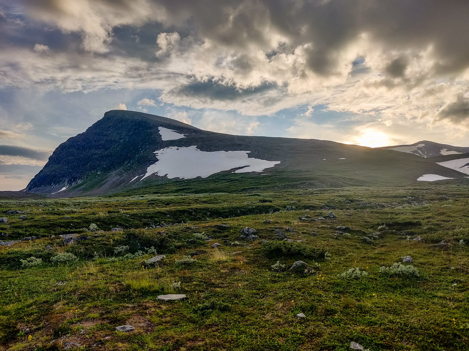
Sunset
HIlariously, with the sudden sun, the heat in my tent was actually uncomfortable.
At about 20:10, a couple of people walked past my tent. They must have been on the later boat and just kept walking.
Approx: 19km
Total: 190km
Day 13 - 31st:
It was a late start on the 31st, only hitting the trail at 9:35 in the morning. I took the time, given the better weather, to empty the tent, turning it inside out to remove the accumulated grit, stones and twigs that always end up inside a tent.
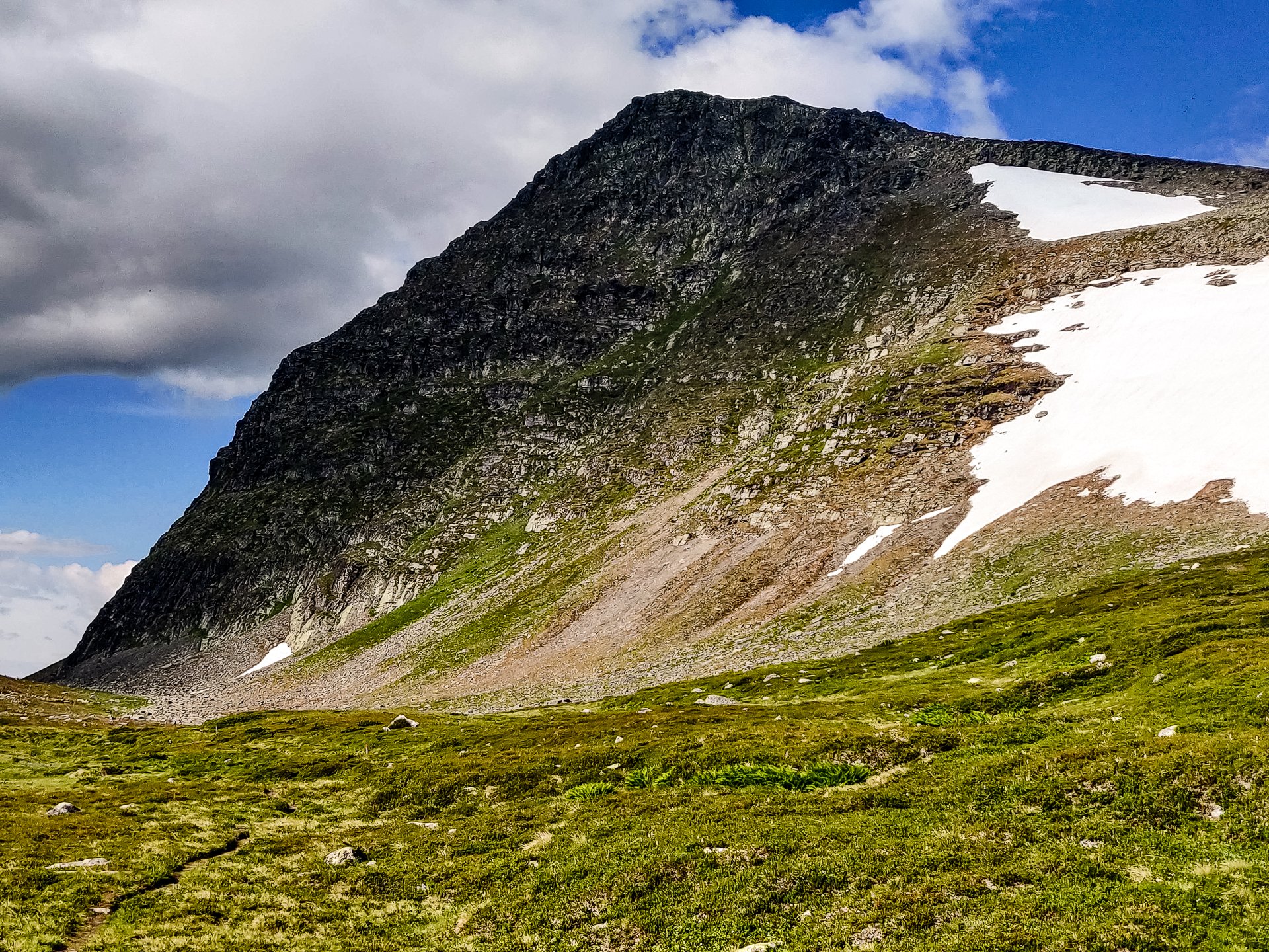
The initial downhill section was narrow and rocky, and very steep but offered beautiful views. Even once down and walking on the flatter sections, the landscape is lovely, with mountains around you and walking alongside a large river.
You slowly enter a forest, with a lot of new growth, overtaking the trail and showing how much less attention this section receives, but the markings are still frequent and clear.
I met three people by midmorning, two of them warning me how steep the hill further along the trail was. My plan was to camp in the lowlands, just before the hill and climbed it in the morning when fresh.
I stopped for lunch on a big rock in the middle of a pine forest. The views were pretty but not as spectacular as earlier in the day. As I carried on, I encountered signs of civilization, huts around the edges of a big lake with motorboats out on the sparkling water. Considering this is the least hiked section of Kungsleden, it is also, strangely, the most populated. Some rivers that connect to roads lead to larger lakes, so people have built their summer cabins.

Sunrise
It had been swelteringly warm, about 20 degrees, and it is interesting what that does. I had finished the first litre of the two I prepare when camping before I'd finished putting up the tent. Normally they are enough for the entire evening and morning, including rehydrating dinner and breakfast.
Sunlight & Shadows
Carrying on a decent distance past the people on summer vacation, I managed to find a pretty but windy spot by a lake before the steep climb up the hill. Two massive bridges span the water, chain-linked and metal mesh bases. I paused after one to take in the view.

Rapid waters
The lake water was ice cold, but I still braved it for something of an arctic dip. I also took the chance to wash out some of my clothes and peg them to the outer canvas to try. Naturally, two hikers walked by as I was mostly naked and getting dry.
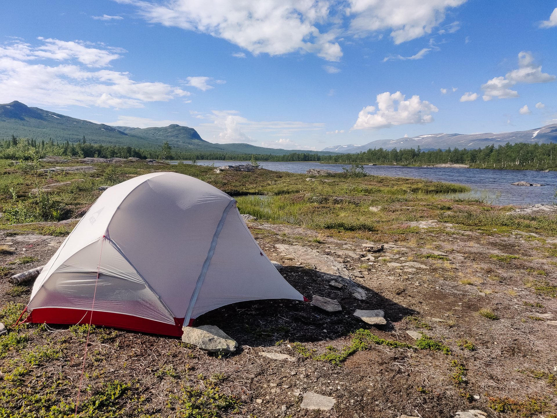
Lakeside camping
The afternoon was heavy forest hiking and slogging through marshland, and it has been nice, but I prefer the rocky, dirt heavy trails on the tops of hills with views into the distance compared to the forests.
Approx: 16.5km
Total: 206.5km (47-52%)
Day 14 - 1st:

Morning sun
A 9:05 start, so a little later than usual. There was no wind, so packing up my tent was easy, but it did mean putting up with swarms of mosquitos. Always the trade on the King's Trail. The sun was out, and it was incredible how quickly the tent got swelteringly warm. At 7 am, I was comfortable and cosy in a sleeping bag and base layer; by 8 was sweating.
The route almost immediately turned to forest, with a reasonable slope upwards. After maybe half an hour, I caught up to the older couple who had passed me the evening before, who had camped in a clearing a little higher than my lakeside spot. They'd seen a herd of reindeer and a pair of moose on the other side of a river and had even encountered a Sami woman who offered them some fresh fish. I have to admit I am jealous, having seen nothing and no one.
From this point, the route got steep. No more so than other sections, but it was still tough. You slowly climb out of the tree-line, not far from the top, I stopped at a stream crossing for three mugs of ice-cold mountain water in the heavy sun, and with the exertion of the climb, it was some of the best water I have ever tasted.
After reaching the top, it is a typical mountain trail, with lots of big and small rocks, pools of water, the occasional fast-flowing stream and beautiful views.
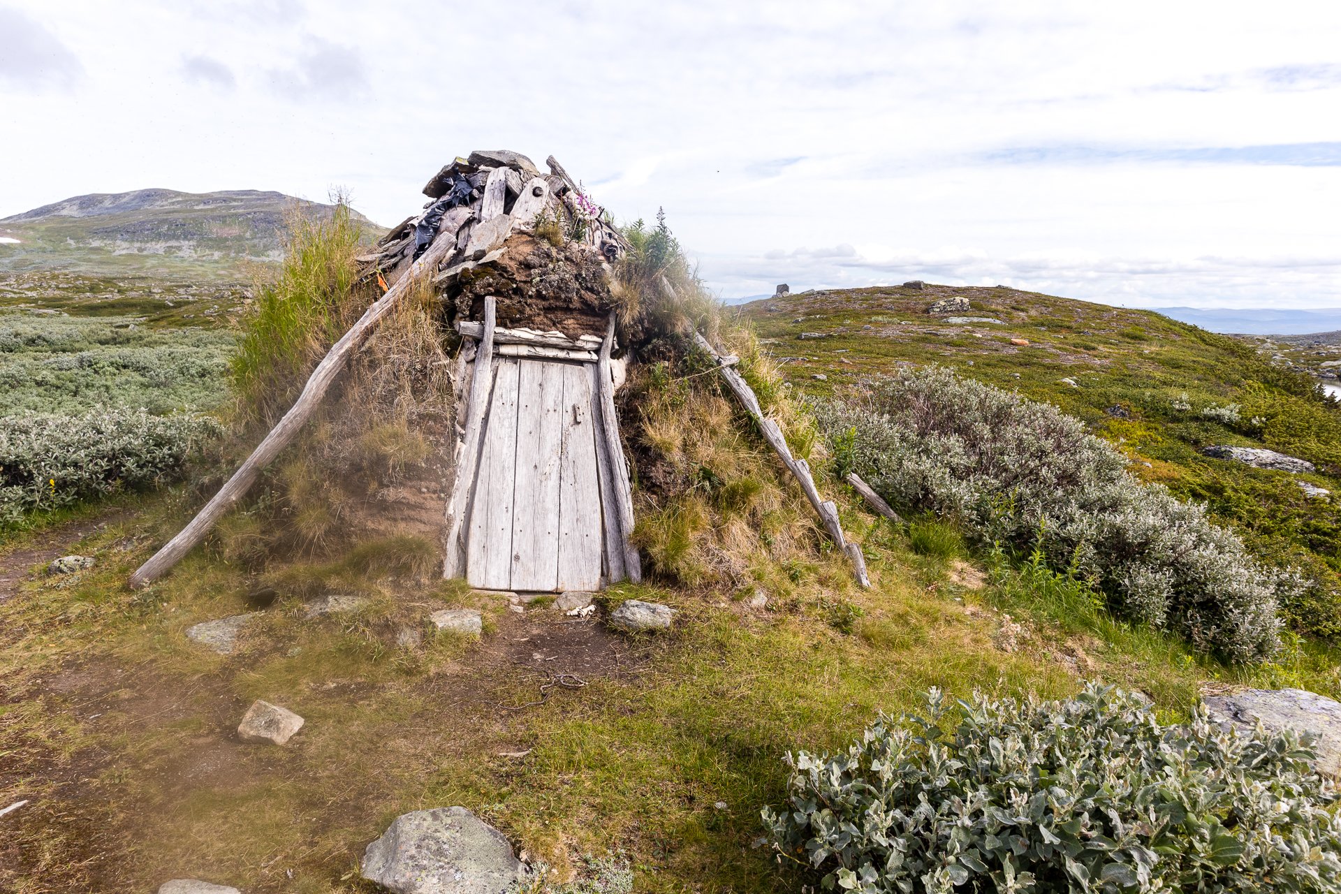
Tjäurakåtan
I stopped for a moment at Tjäurakåtan, the traditional Sami hut on the trail. Made of wood and mud, it commands a view over a lake. Somewhere many people have camped before, judging from the rings of stones and fire pits. From the Sami Hut, you can see, a bit further away, a much more modern hut that has replaced the wood and mud traditional ones, but Tjäurakåtan still seems to be maintained for emergency use. The modern kåtan and traditional one is a strange blending of isolation and connection.
From here, the trail looked easy on the map and fairly flat on the way to the edge of the Arctic Circle.

Distant water
After passing a few streams, a steady climb up, and from there, a flat, rocky, muddy hike. I ended up having lunch with the leftover water from my camel bag as there was nothing for the hour I'd set myself to find somewhere to refill. As I sat on a rock with my lunch, having passed someone doing the same ten minutes earlier, I was joined by a bird, sat on its own rock nearby.

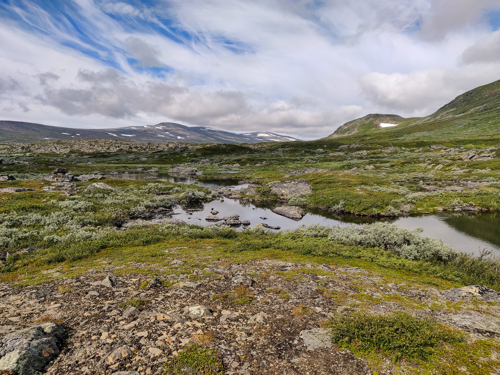
Panorama
The landscape is desolate on the tops of these hills, though strangely attractive, little grows, and what does is faded greens and browns, but everywhere you look, striking white and grey rocks.
River water
I stopped to fill up my water at a river running red with iron and then dumped it for a cleaner source as soon as I could. Whilst not dangerous to drink water high in iron, it does instil a particular flavour to the water that is a little unpleasant.

Arctic Circle Bridge
I found a campsite at the edge of a wooden bridge that was perhaps 50 meters away from the Arctic Circle's edge. I did look to camp exactly on it, but the only spot was an exposed rocky area that was not very flat. The older couple I had passed later caught me up and took that spot. Knowingly or unknowingly camping on the edge of the Arctic.

Sunset camping
I washed up and cleaned some of my clothes out in the ice water stream, but it was so bitingly cold my bones were aching within minutes of being submerged. I made an effort to use the fire pit, but the repeated rains of the previous week had left the available wood too damp to light easily.
I took some time in the sun to carve some more of my walking staff, slowly taking shape as a record of my journey.
It is strange, this section of Kungsleden has fewer hikers, but there have been more signs of civilisation; huts and boats are more common than on the first section, where it is almost entirely STF huts you pass.
Approx: 16.5km
Total: 223.0 km (56%)
Day 15 - 2nd:
It was an 8:50 am start, early and ready to roam. It was a little silly to leave so early, as I had a lovely spot for my tent and had only 9.5km to travel by 6 pm.

Faster rapids
Regardless, I headed off, saying hello to the couple as I passed. Then, it was initially a few kilometres of the thick forest before hitting the island chain, where a bridge had collapsed. This is where the more isolated nature of this trail becomes clear. The second bridge I had crossed was in pieces, both on this section of the trail.

Broken Bridges
There was a lot of mud, but it was generally a good trail; despite the broken bridge, I met a few hikers going north who had been on the morning boat. I asked about the weather as they'd passed through Vuonatjviken that morning, so I hoped they had an update, but they'd not even asked, 'there's nothing we can do about it, so why to worry?' I'm the opposite. I screenshot the forecast whenever I can or write it down from the hut logs.
Vuonatjviken leaps out at you. All of a sudden, from a forest to a large collection of huts and a wide lake.