Etapp 15 - Vuonatjviken to Jäkkvik
A challenging uphill hike from Vuonatjviken South to the tree-line turns into a simple hike across the plateaus, ending with a long forest hike into Jakkvikk, with a short stretch on a resupply road. A few kilometres outside of Jakkvikk, you'll be rowing a boat 300m, which may be challenging if it is your first attempt.
Trail Information
Distance: 18km +5km Boat + 0.3km Rowboat
Difficulty: Fairly Easy (Other than rowing the boat)
Transport:
Boat. There is a boat from Vuonatjviken at 10 am and 18:00 every day, though it only runs if there are people. Coming north, the collection is 30 minutes later, but you should phone ahead to confirm. The cost is 250kr, and you can pay with a card at Vuonatjviken. The mooring point on the south side of the lake is a bit of a scramble up a slope, so make sure you've secured your backpack properly.
Rowboat: Shortly before Jäkkvik, there is the only mandatory rowboat crossing. At only 300 meters, it seems easy, but if you've not rowed before, it will be a challenge. Make sure everything is well stowed. Lifejackets are available on both sides in a sealed box, and the boats are winched up onto land on planks via the prow. Like all Rowboat sections of the trail, you must ensure there is always on at both sides of the lake, so if you are rowing the last one, you'll be doing three crossings. One to the other side, one back towing a spare boat, and a final crossing to continue the trail.
Resupply: Vuonatjviken has a small shop offering dried foods, fishing supplies, soft drinks and other necessities, including things like mosquito spray (stronger offerings than you'll find at the more 'environmentally conscious' STF huts. It is not the largest shop on the trail but has a good selection. No Whole Earth Cola here; they are a Pepsi family.
Accommodation & Shopping
Vuonatjviken

Vuonatjviken
Vuonatjviken is a year-round fishing camp originally settled in 1890 (and called Riebnes). The first settler was Abraham Johansson, married to Anna-Brita Persdotter, Jan Johansson's great-grandfather, the current owner.
Vuonatjviken joined the King's Trail about a decade ago. Previously the trail went in a slightly different direction and included the Kungsleden Ferry to Jäkkvik (the ferry dock is all that remains in Jäkkvik)

View from Vuonatjviken
Vuonatjviken offers a large wind shelter with benches and a big table for its hiking visitors, as well as a fire-pit and drop toilet.
Vuonatjviken has a well-regarded restaurant offering food from locally sourced ingredients. The restaurant was closed during my visit due to Corona, but it is worth planning a meal there if you can.
Recycling is available, but do ask the owners before using it out of politeness.
Vuonatjviken offers cabins to rent, which can work quite nicely with the 10 am boat across, spend the day in Vuonatjviken, sleep in a bed, and then go back on the trail the next day.
It is inaccessible other than by hiking, boat or helicopter and so is not one of the points on Kungsleden where you can post yourself parcels for resupply.
Do make use of the store whilst there, even if it is just for a snack, as running a regular ferry service is vital for continuing the King's Trail.
Vuonatjviken also has a mobile signal, so it's a good place to check up on the weather and let people know you're still alive and hiking.
Vuonatjviken South
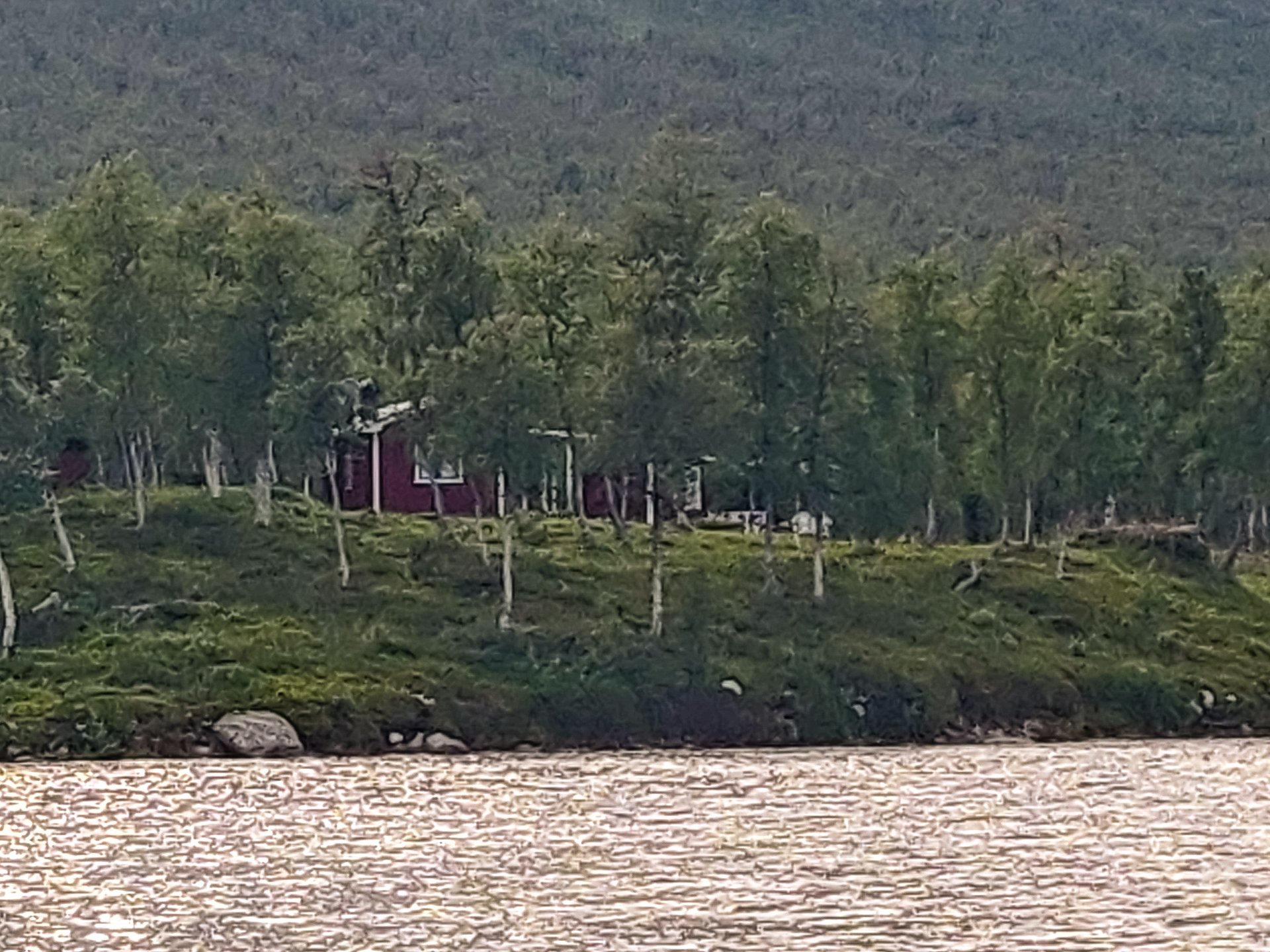
Vuonatjviken South from a moving boat
On the south side of the river, there are a couple of huts, which can be rented from Vuonatjviken, as well as a couple of well-situated campsites you can use, beneficial if you've missed the 18:30 boat and want to be sure to catch the 10:30 morning collection.
The camp is heavily forested, which means it does have a lot of mosquitoes.
Kapellströmmarna

Kapellströmmarna
On the south side of the Tjårvekallegiehtje lake, where the boats are moored, there is a fire pit with benches, a wind shelter and drop toilets if you're not continuing into Jäkkvik, it is a reasonable place to camp for the evening.
Sights
Jäkkvik Ruins
I went a little off-piste trying to find some ruins near to Jäkkvik, they're on the map, and there seems to be a trail, but I could not find them. No matter how short it looks on the map, don't try going cross country to skip going back to the main trail. It takes much longer than you'd expect.
Side Trails
Vuonatjviken
If you stay at Vuonatjviken, you can arrange some fishing tours or boat trips. Either renting a rowboat or going out with the motorboats. You can also explore the forests around the area.
Jäkkvik
As you get closer to Jäkkvik, more and more side trails crossing Kungsleden can be found. It can be very easy to take the wrong route. But for the adventurous, it is a chance to see something new.
The Experience
Day 15 - 2nd:

Finding Vuonatjviken
Before midday, I stepped out of the forest and into Vuonatjviken, right by the Restaurant. After so long in the trees, to be suddenly presented with the signs of civilisation is peculiar. Vuonatjviken has a large collection of huts, a traditional sauna, a big treehouse, and evidence of some of the accommodations' semi-permanent nature, a plethora of children's toys.
The boat runs at 10 am or 6 pm, which makes good business sense as it encourages people to stay overnight in either direction and make use of the facilities.
The dedicated facilities for the Kungsleden hikers are set a little apart from the main huts to give both groups some level of privacy, and the big wind shelter with fire-pit is a great place to while away the time before the boat. The shelter offers views over the lake.
I learned from my mobile data that the rain had been pushed back a day and had been downgraded, so there was noting expected that evening and tomorrow, as long as I was camped by 4 pm, I'd stay try as it was due to end at 8 am.
While I was there, several CAT diggers were visible, highlighting the small fishing community's ongoing expansion. Given the remoteness, I'm at a loss to understand how such heavy machinery was transported to the camp.
The forced idleness of six or more hours in the wind shelter was actually nice. A bit of time on the internet and checking the weather, sometimes carving my walking staff with the distances I'd covered recently and a bit of a wander around the camp. Huge chickens with a run made themselves at home, and a field of purple flowers lead to the waters edge on one side.
I made lunch in the shelter and had a Pepsi and snack from the store. It was a nice change of pace to have a table again.
Jan, the owner, took me over the water in the largest motorboat, bringing his Grandson along for the ride. It was a large boat and not a very long trip, but I suspect he was heading out fishing, and he'd normally do the run in one of the smaller boats, as my drop-off point was at the edge of a small cliff, and getting up took some scrambling. Waiting for the collection was a woman heading north; I used my staff to help her down the slope as it was a bit of a sudden drop.

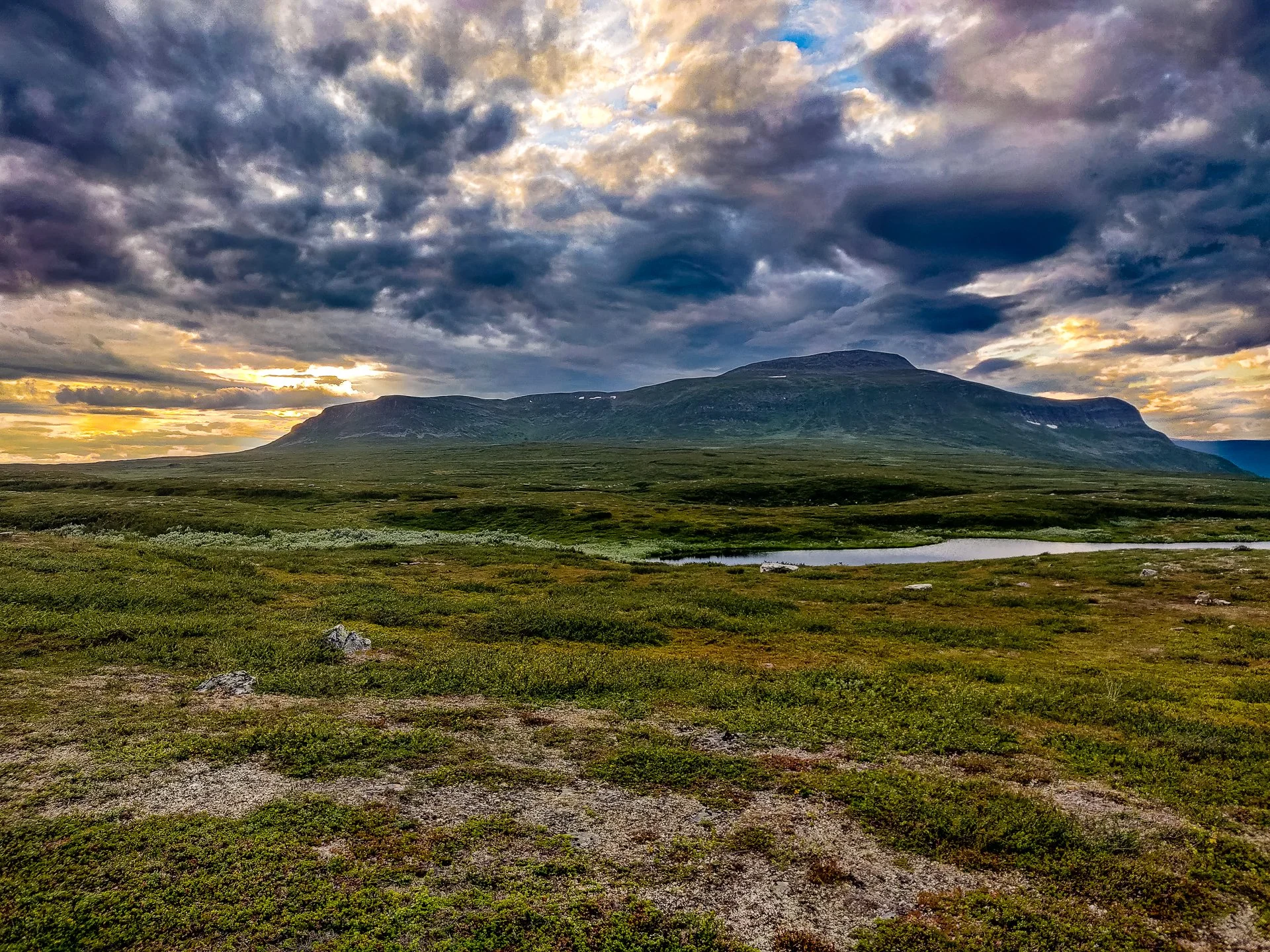
Panoramic View
The first kilometre from Vuonatjviken's southern camp is tough. It's a steep hill. It runs along a good-sized stream for a time, where it is worth refilling your water as there are lakes but little running water on the top of the hill.

Isolated hut
As I planned to get high enough to avoid the mosquitos by getting above the tree line, I climbed the hill. It took me another kilometre walking along the top of the hills before I found somewhere flat, but the walk is beautiful; scattered lakes at different levels reflected the sky like silver, and I set up my camp in the arch of a rainbow.


Passing me, as I erected my tent, two people heading for the base. One who had come from Hemevan and the other from Abisko met the hiker coming up from Hemevan and decided to turn around and follow him north. I've seen romance films with less romance than these two hikers.
Approx 12km
Total: 235km (53/59%)
Day 16 - 3rd:
Incredible Sunrise
9 am start to the day with a straightforward trail through the rocks and a consistent altitude. Once I reached the tree-line, it was initially easy through the beech forest and got quite muddy as I got lower.
As you get closer to Jäkkvik, pay close attention to the Kungsleden trail signs as more and more side trails start springing up.
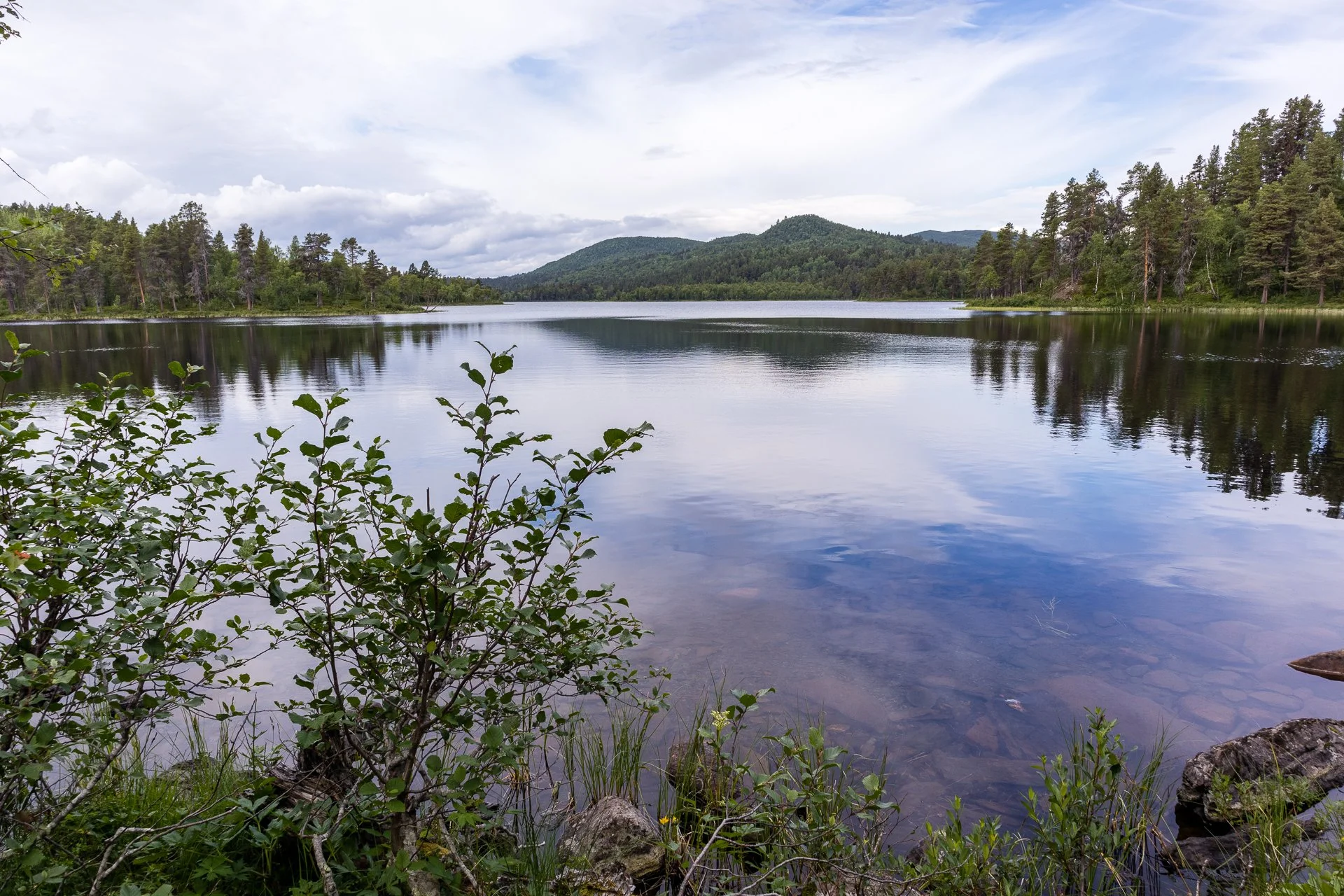
Lake reflections
The hills are rounder and greener now, as you have left the Arctic; it is more vibrant and pastoral. It takes some time to notice the chance and how the environment has softened as it is so gradual.

Powerlines
The initial five or so kilometres after reaching the top of the hill past Vuonatjviken's drop off point goes quickly. You reach a sign in an area of striped down trees with a power line running overhead. This is as close as you come to the village of Savdal, but it is the first real sign of the return to civilisation. The scattered villages and camps we've passed since Kvikkjokk are all isolated. Here there is electricity.
The trail is inconsistent with some really nice forest trails and some deep and muddy frustration after this point.
Row Boats
Approximately five kilometres from Jäkkvik, you reach the rowboats. There were three available when I reached the north shore, which was lucky as I only had to make a single trip, evening out the boats to two on each side.
Its hard work rowing, even just three hundred metres, and I was tired by the end after I finally managed to get the boat ashore with the winch. I made use of the benches in front of the firepit.

Lock
The mooring is only about a kilometre of the forest before you reach a gravel service road that takes you to a bridge built into a lock. After that crossing, you are back into the forest.
At this point, I went off to try and find some ruins that were flagged on the map, but despite finding the side trail, I was unable to find the ruins themselves but did find a solitary pole.
After rejoining the trail, it was an easy hike of another couple of kilometres along a lake. From there, you can see buildings on the opposite side, and there was the sound of many motorboats running around on the lake as I passed.
You break out into some forest buildings, and huts, a few homes and then a road. Crossing a bridge, you reach the T junction. Left takes you to Kyrka Fjallgard hostel, and the next stage of Kungsleden, and going right takes you to the ICA Supermarket.