Etapp 23 - Syter to Viterskalet
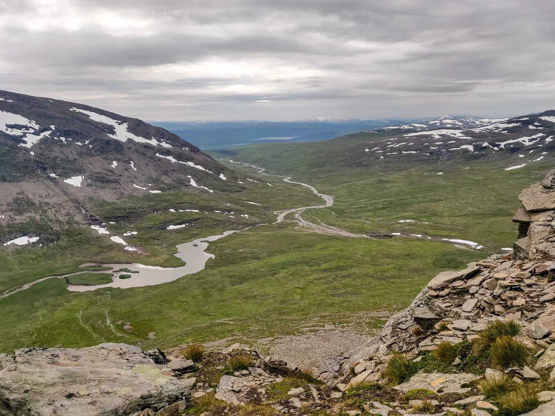
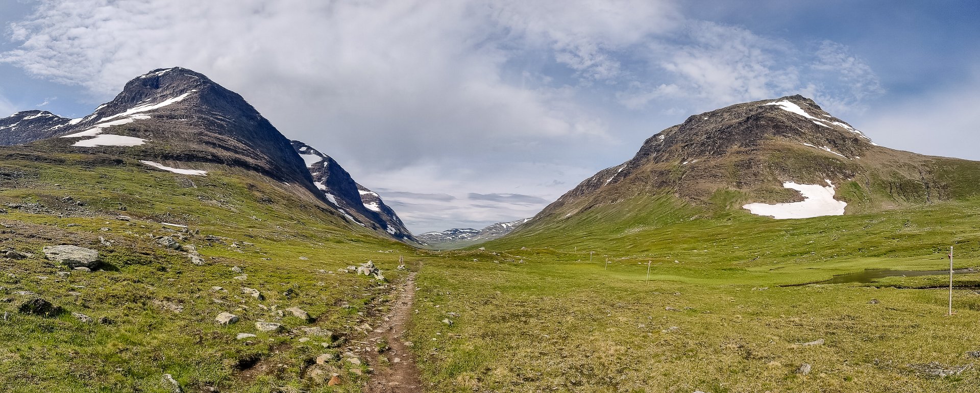
Starting at the King's Trail's oldest cabin, the section between Syter and Viterskalet offers one of the trail's best views, the entrance to the final valley with Norra Sytertoppen on one side. (The hike up to Norra Sytertoppen is a wonderful side trail and worth the climb) Once you enter the valley, the trail is easy and even, and the scenery remains spectacular.
Trail Information
Distance: 13km
Difficulty: Easy (Norra Sytertoppen side trail is tough)
Transport: None
Resupply: None
Accommodation & Shopping
STF Syter Fjällstuga
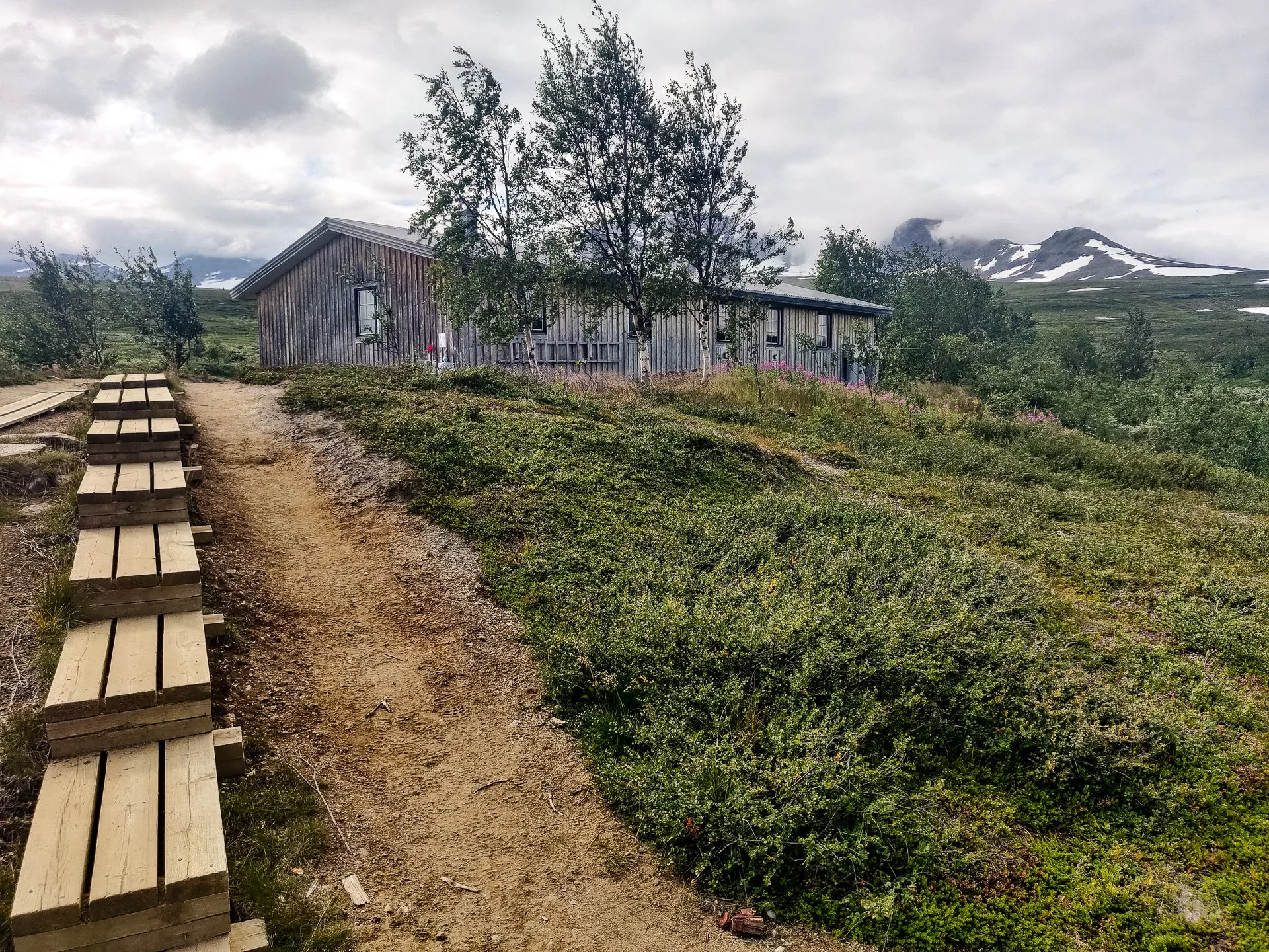
STF Syter Fjällstuga
The oldest STF cabin on the trail, dating back to 1926, Syter sits on a beautiful spot overlooking rapids, with a wooden bridge to bring you to the next section of the King's Trail. They don't have a store but do sell the patches.
STF Syter Fjällstuga Free Camping
They're happy to give you advice on where to camp for free nearby; just over the bridge and along a small side trail, you reach a few good spots for camping with easy access to the river for water. My campsite was only a few meters away from a snowdrift.
Norra Sytertoppen Cabin

Norra Sytertoppen Cabin
Almost at the top of Sytertoppen, an emergency cabin can be found with space to stay. The heavily rocky ground all the way up makes it an unpleasant choice to camp out, but if the weather turns, it's an option for keeping warm and dry.
Syterskal Rastskydd Emergency Cabin
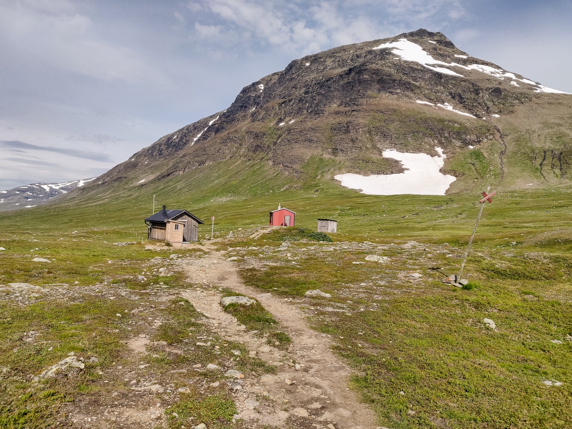
Near the Norra Sytertoppen turnoff, the small Syterskal Rastskydd Emergency Cabin can be found. Its impossible to miss on the main trail between the two walls of the valley.
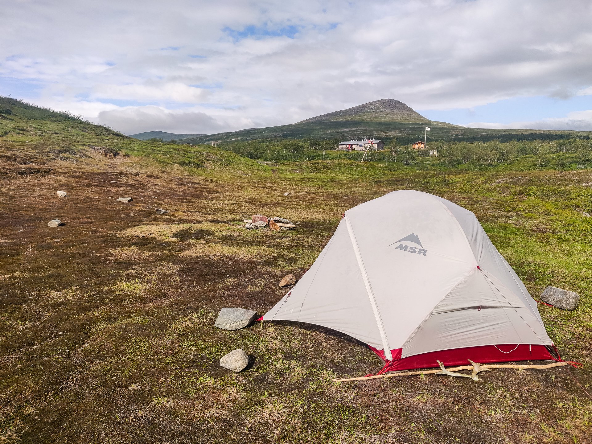
Campground below Sytertoppen
View of the field people camp in before climbing
At the foot of Norra Sytertoppen, in the shadow of the summit, and after you cross the bridge alongside the King's Trail, there is a drop toilet and some good spots to put up a tent. It is easy enough to camp here and climb the mountain.
Side Trails
Norra Sytertoppen

Panorama
Many people climbing Sytertoppen choose to set up their tents in its shadow at the bridge, but an alternative is to do the kilometre walk to Viterskalet and leave your gear there. This does have more of a sense of security and commits you to get back to Viterskalet, getting your gear, finding a campsite and getting it set up after completing the climb.
View from part way up back to Viterskals
I did it that way anyway. The two hosts told me it would typically take seven hours to climb and get back, and it was 13:30 when I was ready to depart. I decided to give it a go and set myself a 2-hour timer. If I were not far enough along by 15:30, I'd turn back.
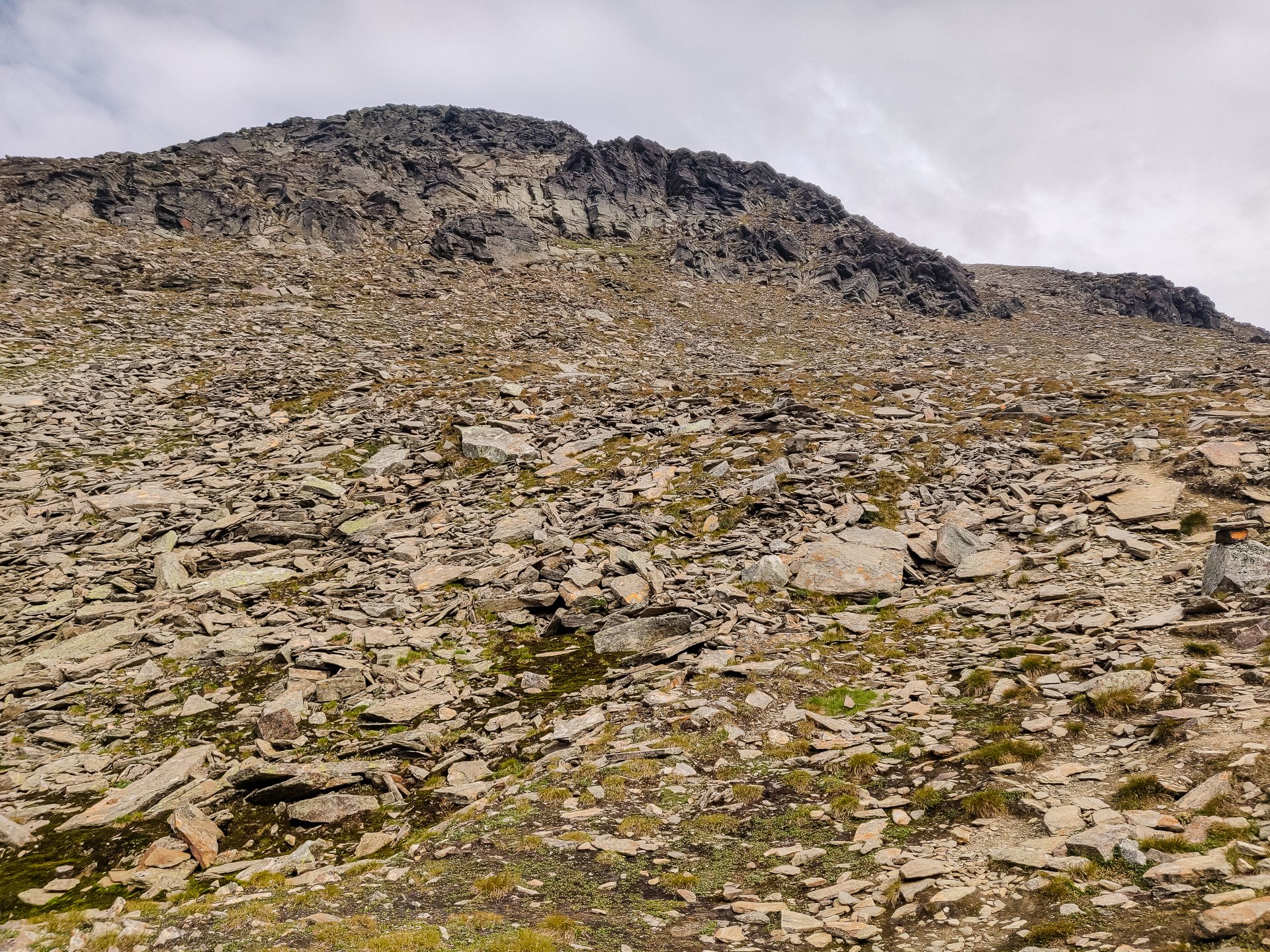
Grass becomes loose rocks
The mountain is formidable; the first quarter is simple, gradually increasing slopes on a dirt trail with grass around it. The second quarter is rockier, the third quarter to the top of the smaller peak is really tough, pure screen, climbing sat a sharp angle. And the final quarter takes you past an emergency shelter after crossing two long stretches of icy snow.
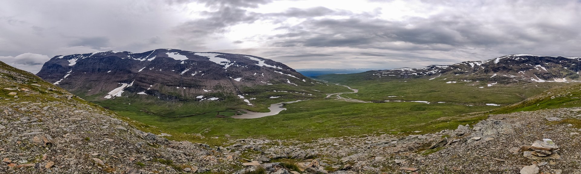
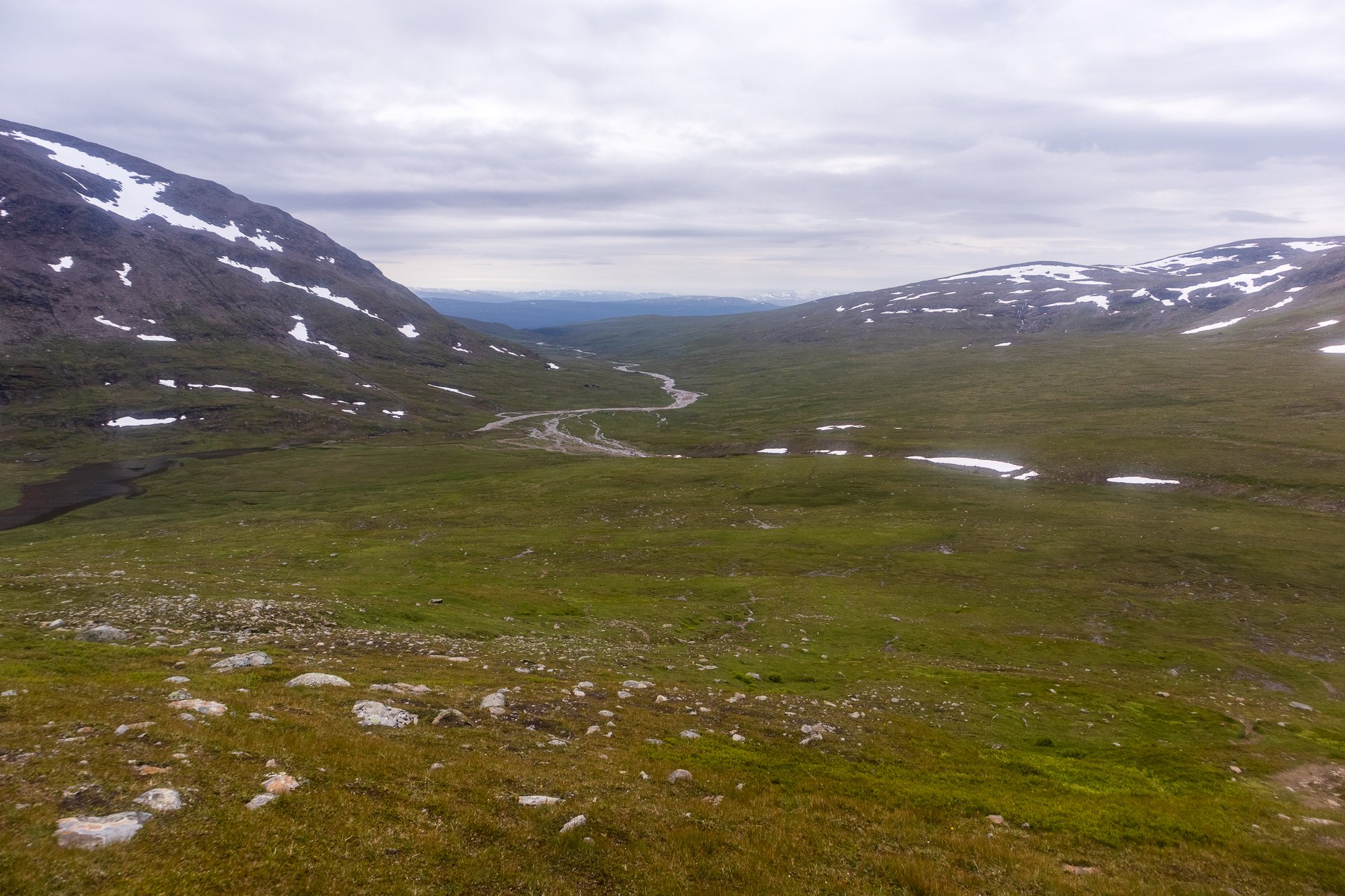
Panorama of the valley
The emergency cabin is perhaps 600-700 metres from the top and involves the steepest and most treacherous climb. It is easy to give up at this point, calling the cabin your destination. Don't give in and persevere. The view from the summit is amazing. You see the corridor you've walked and the waters spread out along the valley, as well as a glacial lake that s just stunning in a deep cerulean blue.

Glacial Lake
The way back was very slippery due to the rain that started just as I reached the summit. The clouds coming in gave me plenty of motivation to descend as the climb was hard enough with decent visibility.

Lack of visibility
In total, it took me five hours, almost exactly from Viterskalet to Viterskalet, which was surprisingly fast; the man I'd met who'd sprained his knee assumed I'd given up partway as he'd seen me setoff.

Panorama from the top of Norra Sytertoppen
Coming back to Viterskalet, I encountered a very close group of reindeer; I had so few shots left available in my camera. At this point, I ended up using my disappointing phone. When they moved on, I grabbed my bag from the stugan and did a short push to find a campsite.
The Experience
Day 25 - 12th:

River bridge
There is a great spot for camping just past Syter, over the bridge on the far side of the river, only a few meters away from some permafrost. Sheltered behind a slight hill on all sides, it's well protected from the wind and has easy access to fresh flowing water.
Once I set up, I started feeling sad the trip was almost over. I wished, in some ways, it was continuing, but I'd be glad to be done and able to sleep indoors and have a hot shower.

Scrub bush
The following day was the final full day of hiking, through the canyon and past the final Stuga. Then it would be a short run on Friday into Hemavan.
The trip to Umea from Hemavan is about 380km on a bus, so only a short distance less than I've walked in four weeks, done in five and a half hours on a bus. It gives you an understanding of how much modern transport has shrunk the world and made everything more accessible.
Day 26 - 13th:
It was a 9 am start from Syter; it is a fairly steep uphill climb for about a kilometre before reaching the plateau and the corridor's first view.


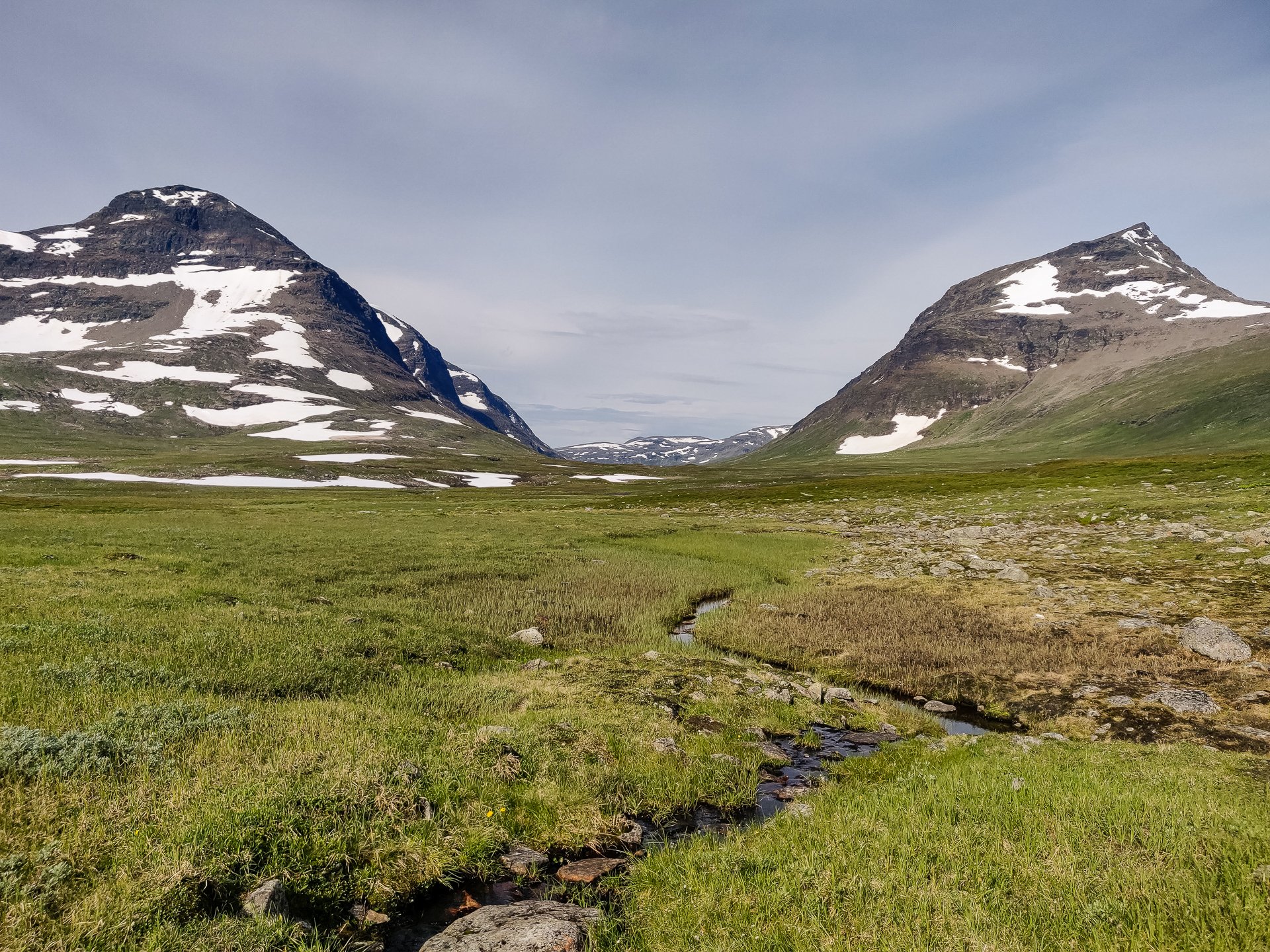
It is spectacular. The trail down is gentle and fairly good until you reach the entrance to the valley where you cross snow and rocks, so keep a close eye on your footing. I met one man near Viterskalet who'd sprained his knee at this stage.
Syterskal Rastskydd Emergency Cabin
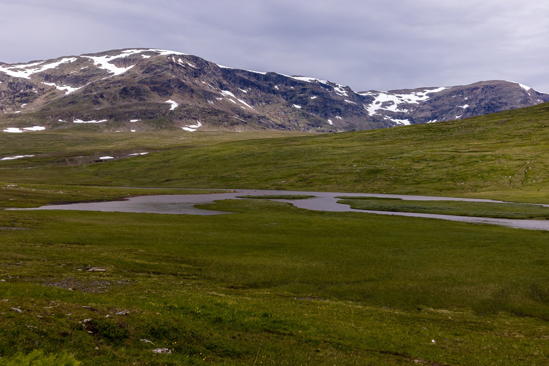
The trail through the valley alternates between rocks and grass, so your progress is varied. You go up and down over a lot of streams deep cut into the landscape. A small emergency cabin called Syterskal Rastskydd with drop toilet is passed before you reach the Sytertoppen trail.

Reindeer
Reindeer can occasionally be seen on the slopes in the distance, and as you progress, you begin to see the rough outline of the trail to Syterstoppen on the right-hand slopes.
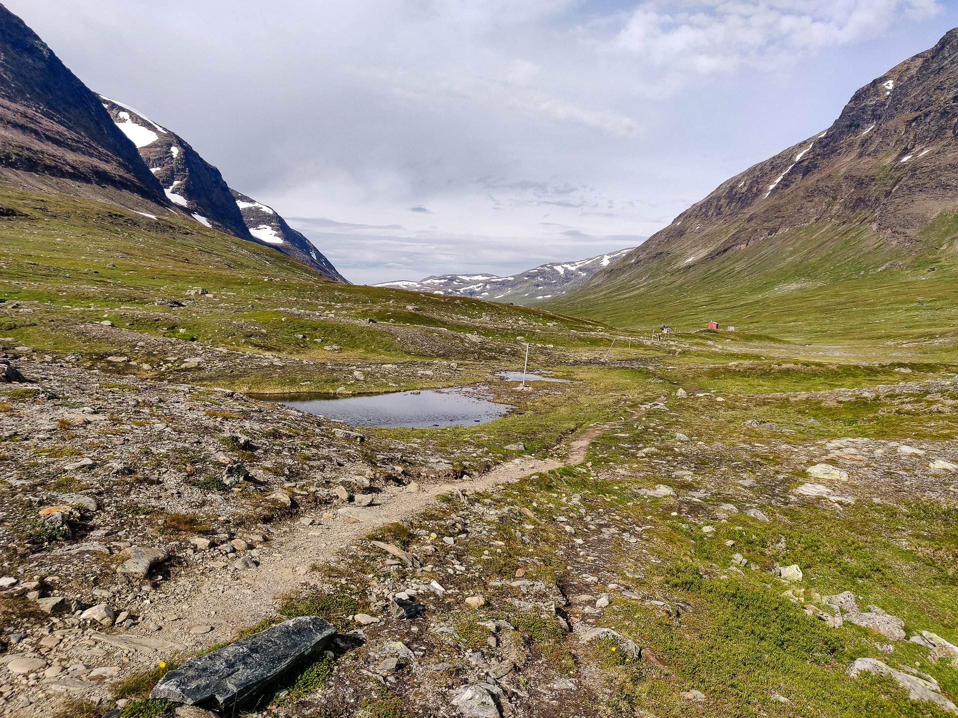
A kilometre or so before Viterskalet, there is a bridge where you can cross to climb Sytertoppen, with a toilet and good camping grounds.
Viterskalet is a short distance away, on a small hill overlooking the river. It is the final (or first) cabin on the trail and only 18 kilometres from Hemavan.