03 - Shira Camp - Barranco Camp
Trail Information
Distance: 10km
Difficulty: Easy - but also where the altitude first really hits you.
Transport: None
Terrain: Kilimanjaro spans five ecological zones. Each day progresses through one or more of them.
-
Where people live, work and farm. this is the main altitude of Tanzania.
-
Mountain forests and evergreen. Heavy rainfall and high humidity.
-
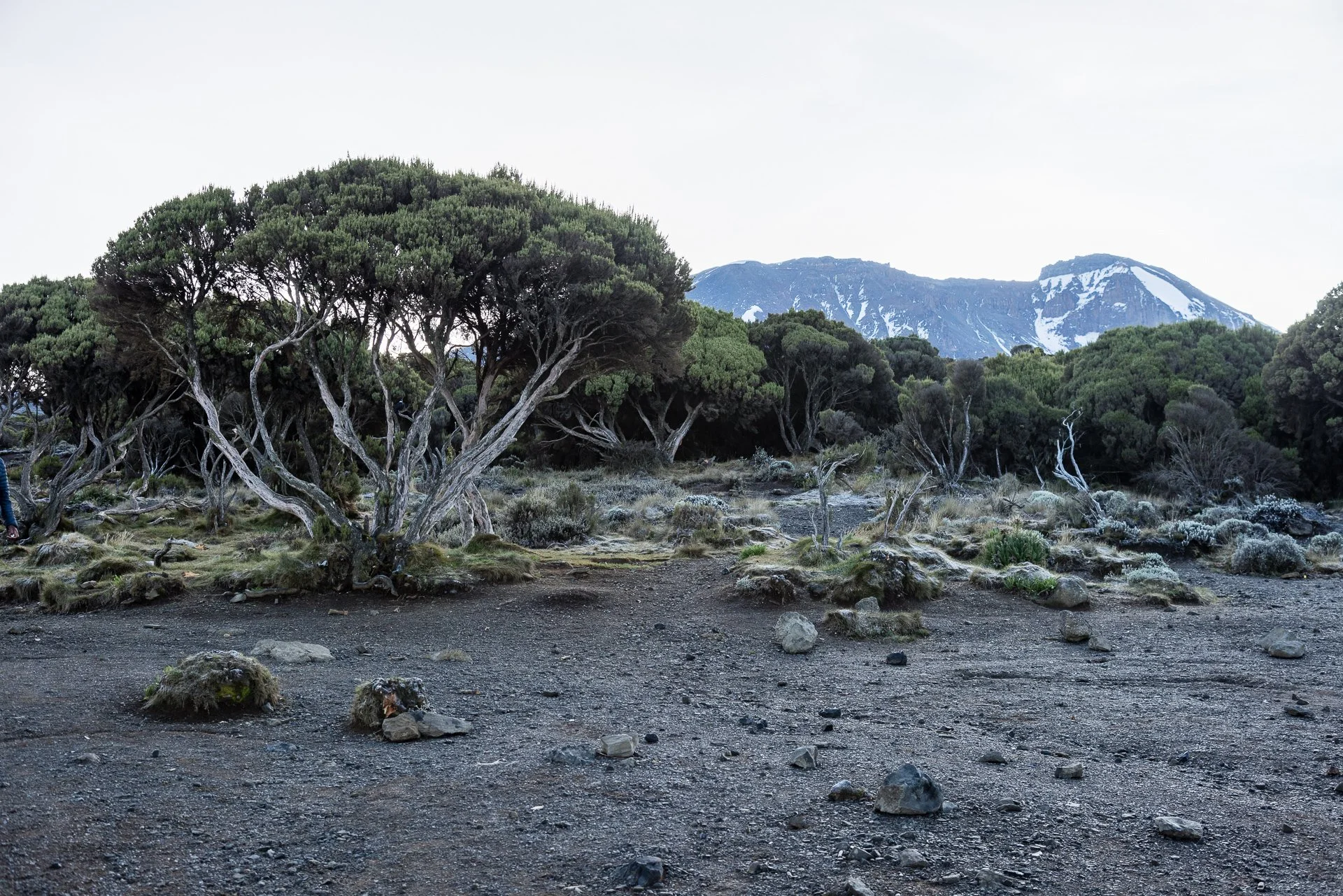
The start of lower oxygen and stranger flora. There is little tree cover and the change from rainforest to moorland is both dramatic and obvious.
-
You will see some real changes in your body at this altitude, very few animals and plants live at this level.
-
Hail, snow, freezing winds are all possible. Nothing lives at this altitude. Rocks and stones are your only friends.
Starting in the moorlands zone, you rapidly move into the Alpine Desert for the first time before getting back into the Moorlands to camp at Barranco Camp.
Accommodation & Shopping
Shira 2 Camp
The campsite is more or less a clearing on the edge of one part of the trail. A decent toilet block is available and its tile walls and floor are regularly rinsed down to keep the mud (and other things) to a minimum.
Shira 2 Camp
The views are lovely though clouds often obscure the details.
One of the only camps on the Machame Route accessible by car, the omewhat overgrown helicopter pad indicates how much more often the hikers are able to make their way down in a resuce car.
Altitude: 3810 meters
Sights
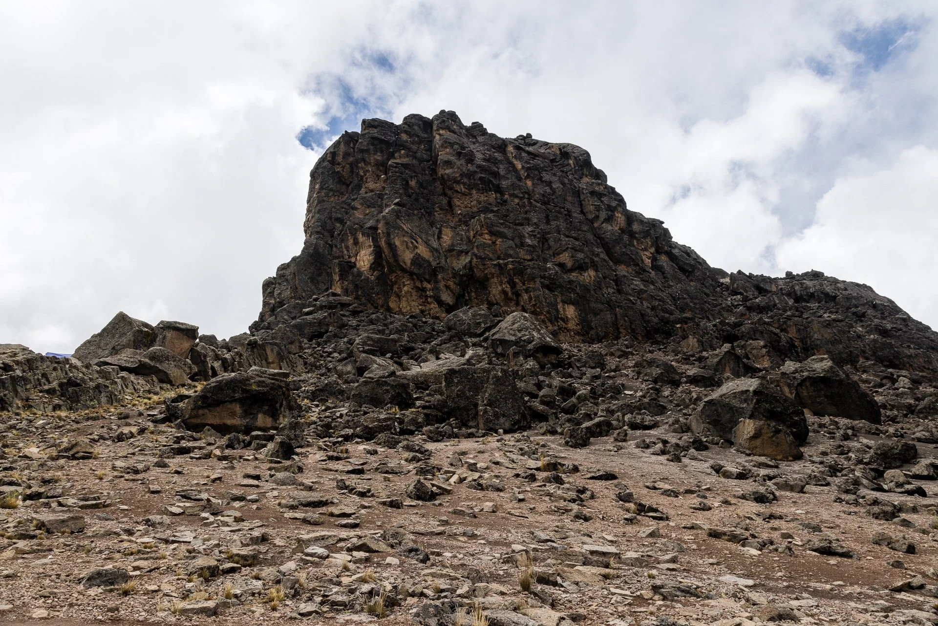
Lava Tower


The Lava Tower is impressive, rising up in front of the campsite, dark stone causing a shadow over the tents. Its easily visble from some distance due to the flat plain around it. A wall of loose rocks hems in the Lava Tower camp site for those staying at this altitude. The Tower itself is not stable enough for climbing, though no doubt many have tried regardless.
Altitude: 4,630 meters
Side Trails & Add-ons
Lemosho Route
Not really a side trail, but the Machame and Lemosho trails merge at Lava Tower. It is one of the few places on the hike were its possible to get lost by taking the wrong route and ending up back at the bottom of the Mountain.
The Experience
Day 03
I woke at 5am, with the sounds of the porters preparing our breakfasts but stayed in my sleeping bag doxing until 6:30 when the coffee came around. Partly to keep my energy up, partly not to wake my tent-mate.
I packed whilst breakfast was being finalized, following the Guide’s advice that we should be prepared for cold weather, so I put on a base layer below my trousers.
After filling up on food, we headed out, pretty quickly getting above the moorlands and into the Alpine Desert. The landscape as we walked was dramatic. Tall outcroppings of dark stone with yellow moss hanging off of it in strange patterns. The scenery could have been used in any number of science fiction films to represent an alien world. It was also nearly silent, the only noise was our hiking.


We walked closer and closer to the Lava Tower, one of the notable sights on the Machame Route and the paint at which the Lamosha trail merges with the Machame. The landscape was desolate, browns, blacks and greys with the occasional scattering of colour from the rare plant.
The hike is technically easy, but the altitude as you move from 3,800 to 4,000 to 4,400 and then to 4,630 at Lava Tower makes things surprisingly tough. Even mild exertion causes a stronger reaction as you struggle to pull in enough oxygen. A few times I hung back to grab a photo or two, and when i walked ever so slightly faster to catch the group I was out of breath and the start of a headache came on.
Nearing the Lava Tower, huge ridges span out over valleys and when we stopped for water we were surrounded by small birds who had no fear of people.

We then did the final twenty minutes to the Lava Tower, the final stretch is relatively flat with the tower looming up, dark and foreboding in front of you.
Lunch was in our main tent, already setup with the food prepared. It was a delicious meal of sweet potatoes, squash and a few other vegetables in a yellow sauce, called Ndizi na nyama.
We then started down towards Barranco Camp for the evening. We would be losing a lot of the altitude we had gained over the mornings hiking as we moved down to Barranco. The first few minutes from Lava Tower were a steep climb down to a small stream cutting through the rocks, before back up a little and walking along the edge of a slope. The trail is good, mostly straightforward, slowly losing altitude until you start reaching the moorlands and you realised you’re seeing a lot more trees. Not that many compared to the Rainforest, but its amazing how quickly you' become accustomed to the Alpine Desert. In the moorlands the trail is more stepping down than walking a gradient, which is a change of pace, but harder on the joints.


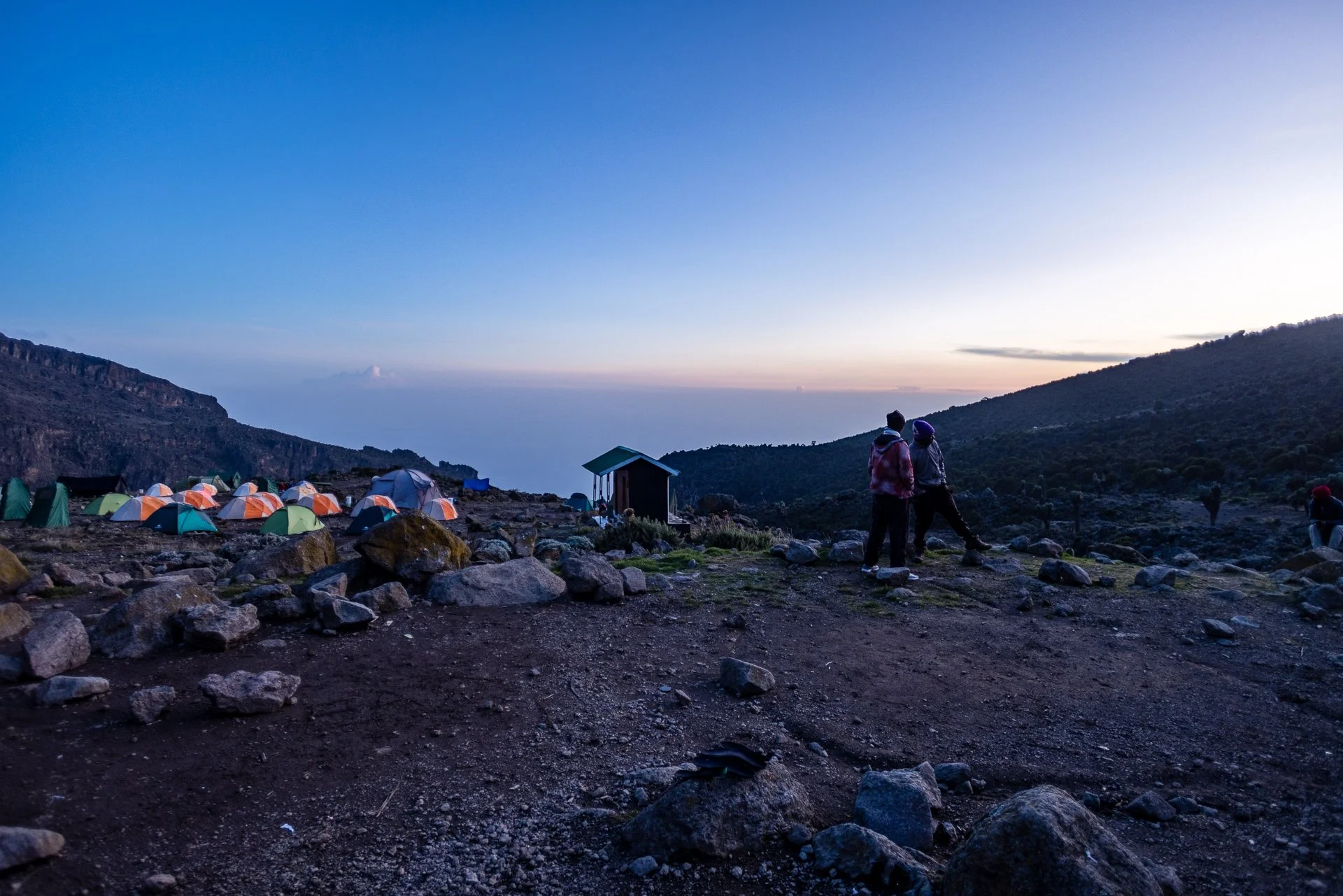
A cheer from ahead of me signalled when the front runners saw our campsite, and it took another 15 minutes from spotting it to reach the site itself.
The campsite is the biggest we’ve stayed at as four trails merge at the foot of the Barranco Wall. We were warned even with the reduced tourists on teh trail, the toilets might be a little grim.
On three sides, the Barranco Wall rises up around you, and the fourth side gives views down to the settled lands of Tanzania. It is a surprise how close the real world seems. A disconnect I found when hiking Annapurnal in Nepal as well.
We all settled in to the camp, washed up, prepared our tents for the evening and some of the crew took the change to haev a few hours nap. The rest of us hung out in the main tent drinking ginger water.
There was a strange sense of anticipation and fear about the next days hike. Eight hours hiking, followed by six hours from midnight to Stella Point for the sunrise and then a further hour to Uhuru point. At least fifteen hours of hiking, upwards, to altitudes we’ve never reached. Mentally we need to be prepared.
Editors Note: Something I realised the following day, and that this paragraph highlights, both we and the guides were focused on summiting. All our talk and preparation was about getting to the top of Kilimanjaro. We really did not think much about the eight hours additional hiking required from the peak to the camp.
Our evening briefing was focused on getting us to Baranfu Camp, the base-camp for the final push to the top. The main challenge between here and there is the huge Barranco Wall. (Sometimes called the breakfast wall as that’s when you’ll be climbing it!).
Sunset was gorgeous, the light illuminated the peak of Kilimanjaro in vivid white, and the scattered tents gave colour and scale.


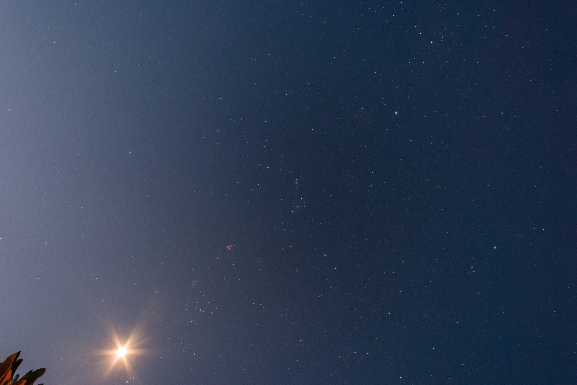
Once again I aimed my camera upwards to capture the night sky before going to bed.
Total Distance: 10km (7km to Lava Tower. 3km to Barranco Camp)
Altitude Gained: 820 meters (Lava Tower) 166 meters at Barranco Camp