Etapp 17 - Adolfstrom to Rävfallet
Starting with a hike or optional boat ride along the lake, the trail from Adolfstrom to Rävfallet is one of the longest sections. It starts with forest hiking before moving up to above the treeline and hiking along plains and rocks. A reasonable section of the trail, with Sjnulttjie as an option, if the weather turns bad, Be aware, a few kilometres around Sjnulttjie, you pass through a bird sanctuary with restrictions on where you can camp. Much of the rest of the trail to Rävfallet is in the shadow of the nearby hills and on good trails, with the final section in a deep forest before you come to find the cabin at Rävfallet.
Trail Information
Distance: 40km + 8km Optional Boat or 48km Total hiking
Difficulty: Easy. Lots of winding trails along rivers and over bridges.
Transport: Boat (Optional)
You can quite happily walk around the lake to reach Bäverholmen, it is about 8 kilometres, or you can take the boat from Adolfström. Marianne in Adolfströms Handelsbod & Stugby can help you book the trip. It runs by arrangement rather than on a schedule so that it can be convenient, or you may need to wait for a little if they're busy. It costs 200kr and has to be paid in cash.
Resupply: Adolfströms Handelsbod & Stugby has a range of goods and freshly made produce to buy. It is not as large as Jäkkvik's ICA or even Saltoluokta, but it still has a decent selection to choose from to get you to the next stage.
Accommodation & Shopping
Adolfström is a small village, but one focused on fishing and hiking and has a few options for staying overnight and a small store.
Adolfströms Handelsbod & Stugby
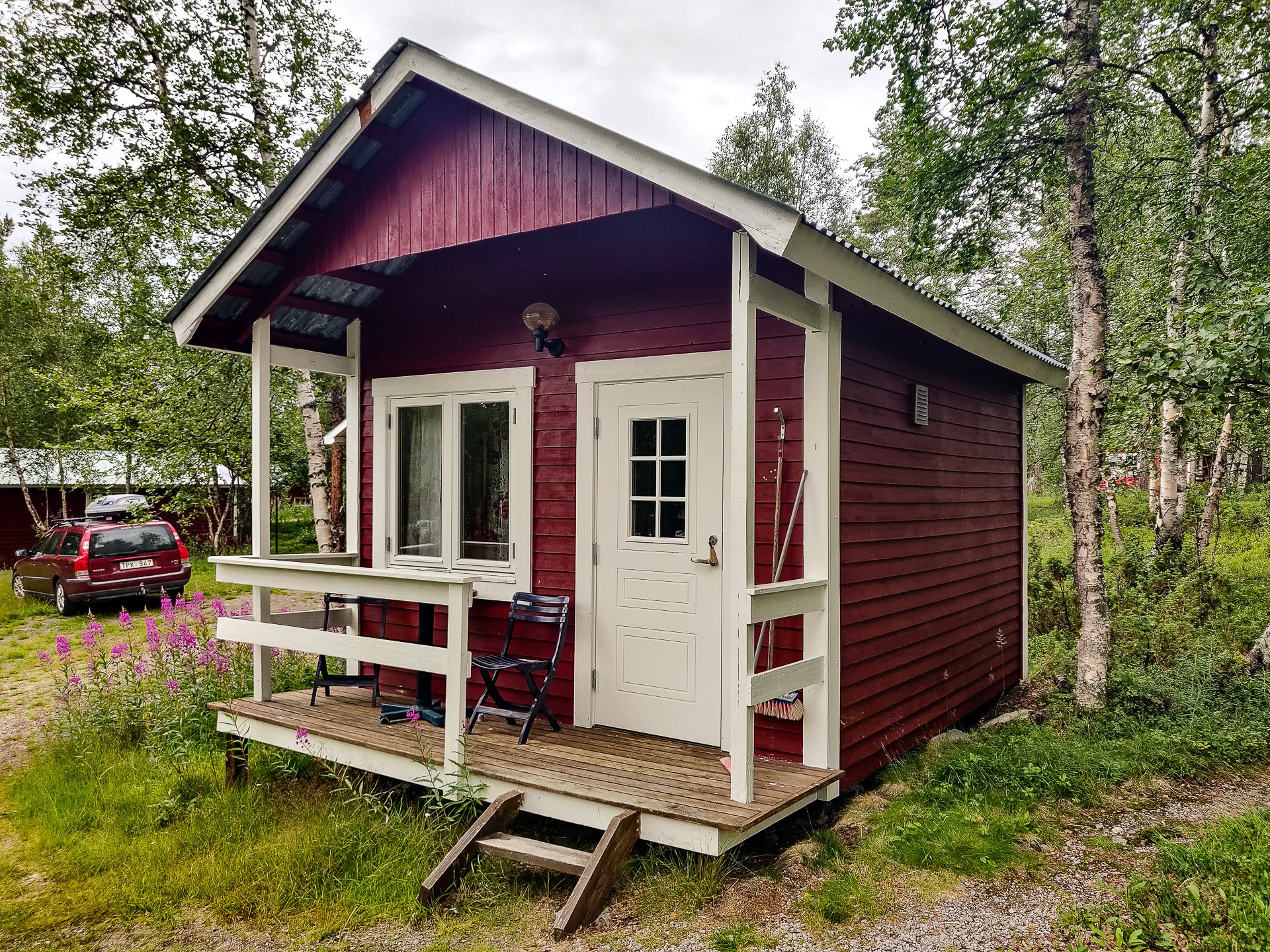
Adolfstrom's Lillabo
Offering a range of cabins from the tiny but cosy one I stayed into larger offerings for big families, Adolfströms Handelsbod & Stugby is run by Marianne and Jan Thorfve. Marianne runs the store, and Jan, described as a genuine mountain man by his wife, offers a range of guided experiences.
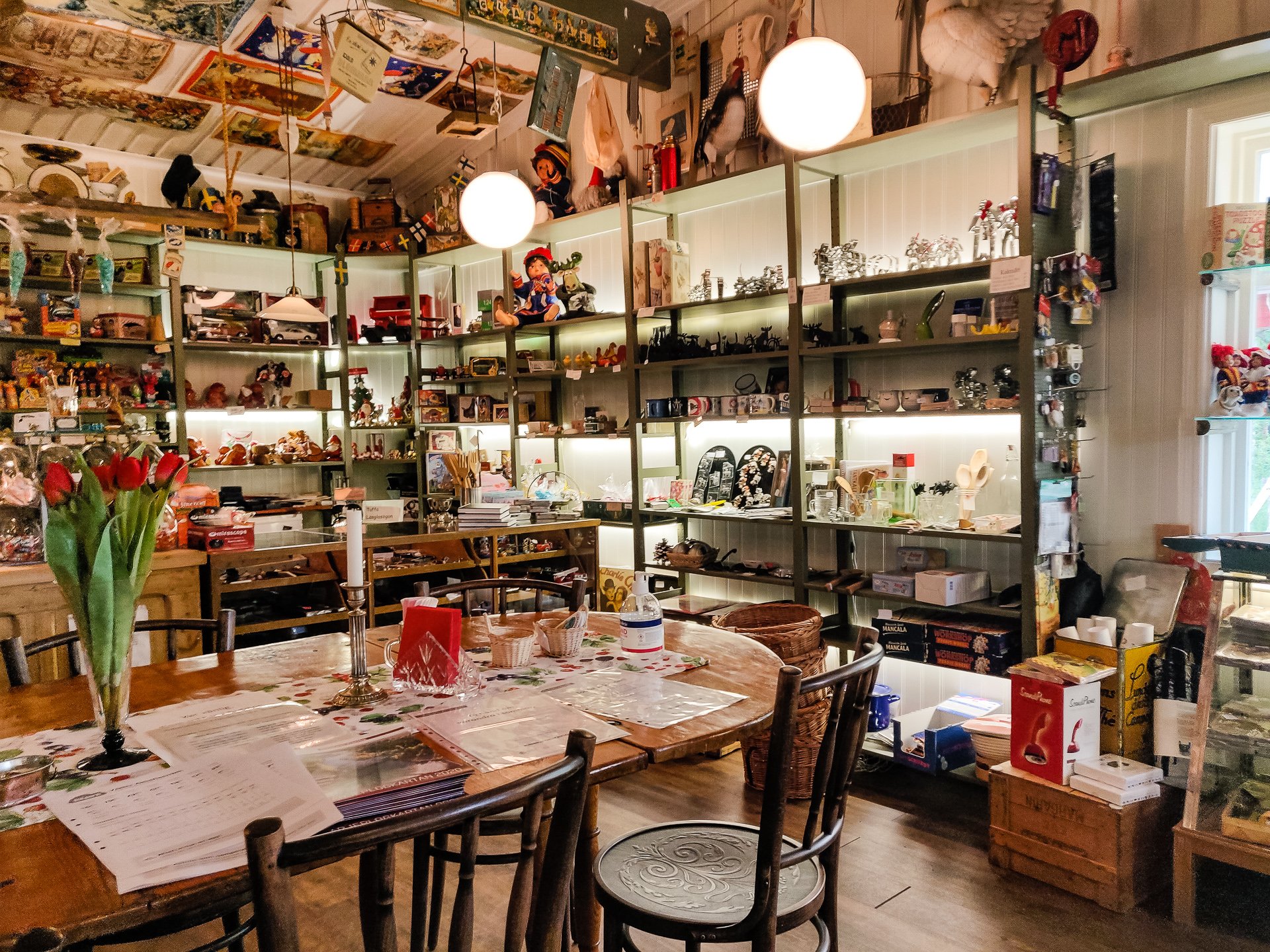
Lillabo Interior
The accommodation prices are very reasonable, the huts are well equipped and comfortable, and the shower block's showers were hot. Men's and Women's saunas are also generally available, though under repair during my stay.
Adolfströms Handelsbod
The store is a mix of three things. For the hiker and fisher, there is a corner offering all the resupply you've come to expect on the trail, dried foods, beans and other provisions, as well as other easy to carry snacks and various fishing equipment. Secondly, they have a wealth of retro ornaments and items. (Which can be bought on their online store too) and whilst cool, are impractical for someone hiking the King's Trail to shop for and finally, they have a range of local, fresh produce from reindeer meat to freshly baked bread (Strongly recommended).
Also, the store operates as a cafe and serves up a lovely Fika.
Adolfström Johanssons Fjällstugor
A little further from the lake, Adolfström Johanssons Fjällstugor offers accommodation and helicopter rides.
Adolfströms Camping
A large campground focused on RVs rather than tents though offering space to both, can be found on route to the Hyttruin.
General Camping
Opposite the bus stop and right by the lake are two free camping spots with fire pits and benches available if you prefer to keep roughing it. There are also drop toilets by the dock.
Bäverholmen
At the other end of a boat trip, the restaurant Bäverholmen has plenty of space to camp if you'd rather have a cooked dinner than making something yourself in Adolström. The boat will drop you right off outside, though you're probably not getting back to Adolfström without paying extra for an out of hours trip.
Bäverholmen
Quite a few hikers will take the boat to Bäverholmen and camp to get an early start the next day rather than wait for the morning boat collection in Adolfström.
Badasjåkkå Rastkkydd
Badasjåkkå Rastkkydd
A large, well-appointed cabin with a drop toilet and fire pit. I was there too early to stop for lunch, but otherwise, it would be a good option for a break
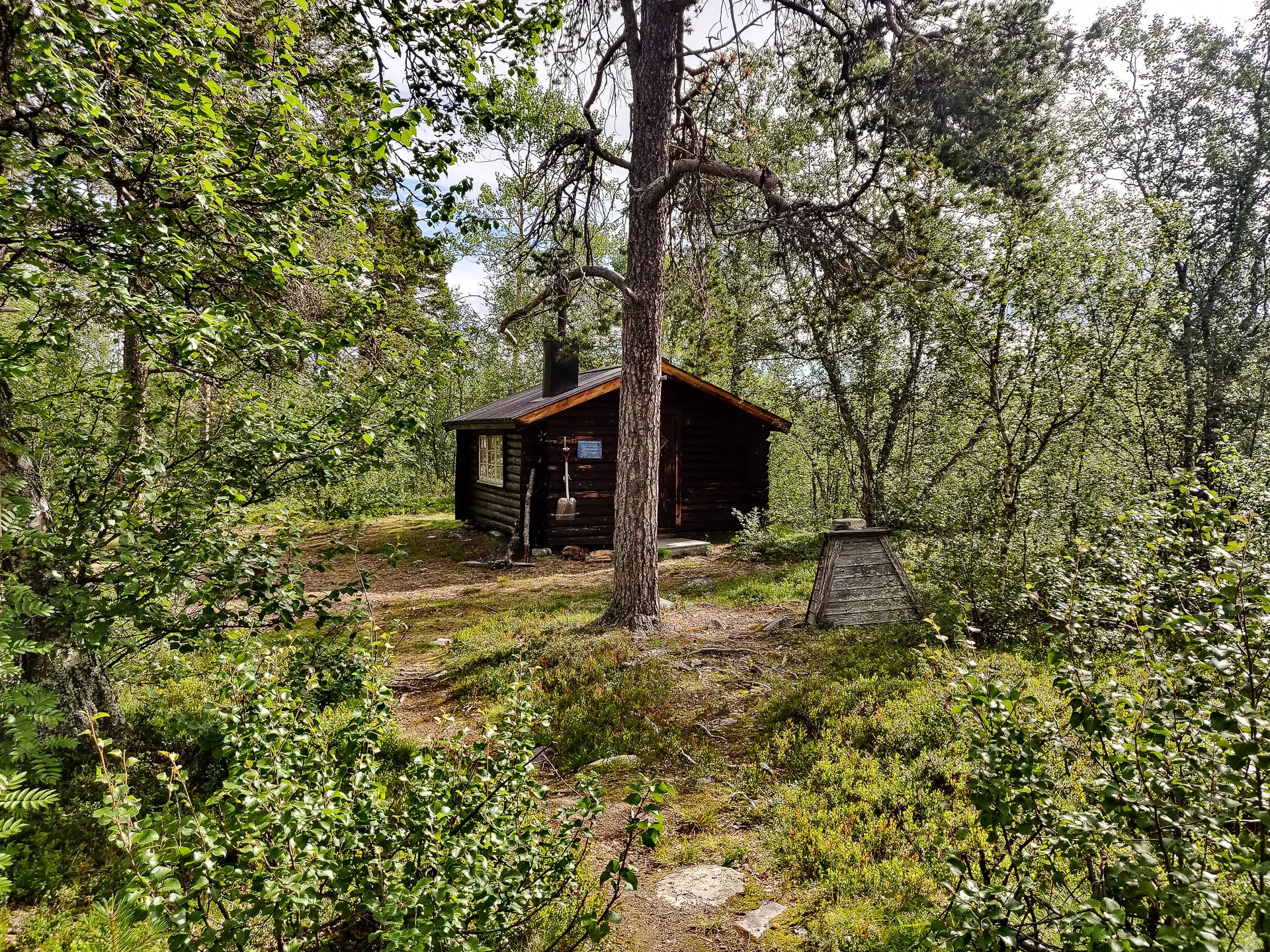
Sjnulttjie Emergency Cabin
About halfway between Bäverholmen and Rävfallet, and less than a kilometre off the Summer trail, you'll find Sjnulttjie cabin with drop toilets, wood and a good-sized inside space. However, I could not see nearby running water, making it less than perfect as a stopping point.
Sights
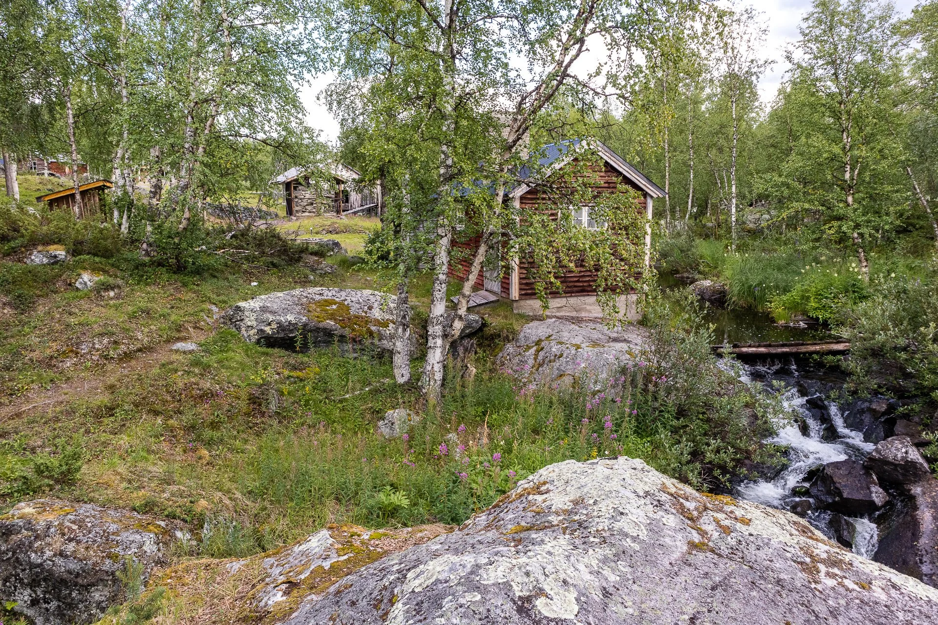
Adolfström Hyttruin
Adolfström Hyttruin
When I got to Adolfström, the original silver mining town ruins were not even on google maps. It was only a chance to view Pokemon Go that led me to the entrance and the fascinating remains. From the washing hut to the lumber mill (a familiar structure to any Skyrim players). Well worth the visit.
Adolfström Hyttruin sawmill
You can see its location on google now: Adolfström Hyttruin.
Adolfström Hyttruin
Side Trails
Helicopter Rides
Several of the accommodations offer helicopter rides out over the local area. Given the spectacular landscapes, it is something I wish I'd had time to arrange.
The Experience
Day 18 - 5th:
The cabin I'd hired was part of Adolfströms Handelsbod & Stugby, a short walk from the T junction that marks the connection between the King's Trail and Adolfström. Surrounded by tall purple flowers, the location has many cabins available, and I'd reserve Lillabo, the smallest (1-2 comfortably). It's cute and cosy with a table, comfy chair and bunk beds, as well as a small kitchen area. There is electricity but no running water (this can be obtained at the services building nearby). The service building offers water, toilets, showers and even a sauna.
The shop/cafe is adorable, full of retro memorabilia and some local handicrafts and produce. (The bread is excellent) Marianne also seres a great fika, cappuccino, and kanelbullen made me feel almost civilised again.
Adolfstrom lake
With a lot of time to kill, I went for a wander, first down to the dock, a lovely spot with great views over the lake.
The trail continues around the lake, or for 200kr, I decided I'd be taking the boat directly to Bäverholmen.
Hyttruin
After the dock, I headed along the trail and found the Hyttruin, the remains (in traditional Scandinavian Outdoor Museum form) of the original Adolfström, the silver-mining town. The watermill, cottages, lime kiln sauna and washing room, are all in good condition, and the foundation stones for the smelter and furnace are also visible. It's a picturesque spot and easy to find from the road, thanks to the large wood carving of a miner and the road sign. As it was not on Google Maps, I added it there too.
After the mine, I headed back to my cabin and ran into five other hikers. One was the man I'd met in the wind shelter quite some time back and again in Kvikkjokk. It turns out he'd taken ill in Kvikkjokk, which is why I'd not seen him on the boat south. The other four, two guys and two girls, were all heading directly off to the boat, so it was unlikely I'd see them again, but they took the time for fika.
It was nice, sitting on my little cabin's porch, carving my walking staff, watching the occasional person go past, with nothing to do and nothing pressing me onwards. That evening I ate a meal on a plate with knife and fork, sat on a chair and used a table, which has been a nice change from a plastic bag and sitting cross-legged in a tent.
Sunset at Adolfstrom
I did my good deed and helped a hiker find his campsite and where his Helicopter ride was taking off from, and later heard it leave; the consequence of an action is so clear in the wild.
Approx: 8km
Total: 278km (67%)
Day 19 - 6th:
Early morning at Adolfstrom
I was up and ready, as I seem to be, at 9 am regularly. I watched the birds fishing in the cool waters of the lake as I stood on the dock waiting for my shortcut to arrive to take me to Bäverholmen. I was joined on the trip by the driver's wife and young son, heading over to prepare the restaurant for the day. The son was mostly interested in moving rocks from the shore to the lake.
Bäverholmen
It would have been an eight-kilometre hike, depending on conditions, perhaps three hours, or for 200 kr, a twenty-minute cruise in a motorboat. One of the two 'optional' boat rides on the King's Trail (the other being to reach Alesjauretugan).
The restaurant is set in spacious grasslands with several buildings scattered around. Campers had set up for the night near the signs marking the trail, using their hiking poles to create a tripod to hold their solar panel facing the sun. Bäverholmen is open from 12-18 daily, making it a more popular choice with those coming north rather than south. Stop for lunch, take a quick boat trip or three-hour hike and stay the night in a cabin in Adolfstrom.
The sign says 49 kilometres to Ammarnäs, which was a concern as the book told me it was 66 from that point. At only 49 kilometres, I was concerned I'd get to Ammarnäs at least a day early. (Spoilers, there is a 'short' route which skips Rävfallet and goes straight to Ammarnäs, which the signs are referencing. This is 'technically' not on Kungsleden, and so the signs are definitely misleading.)
Laisälven Bridge
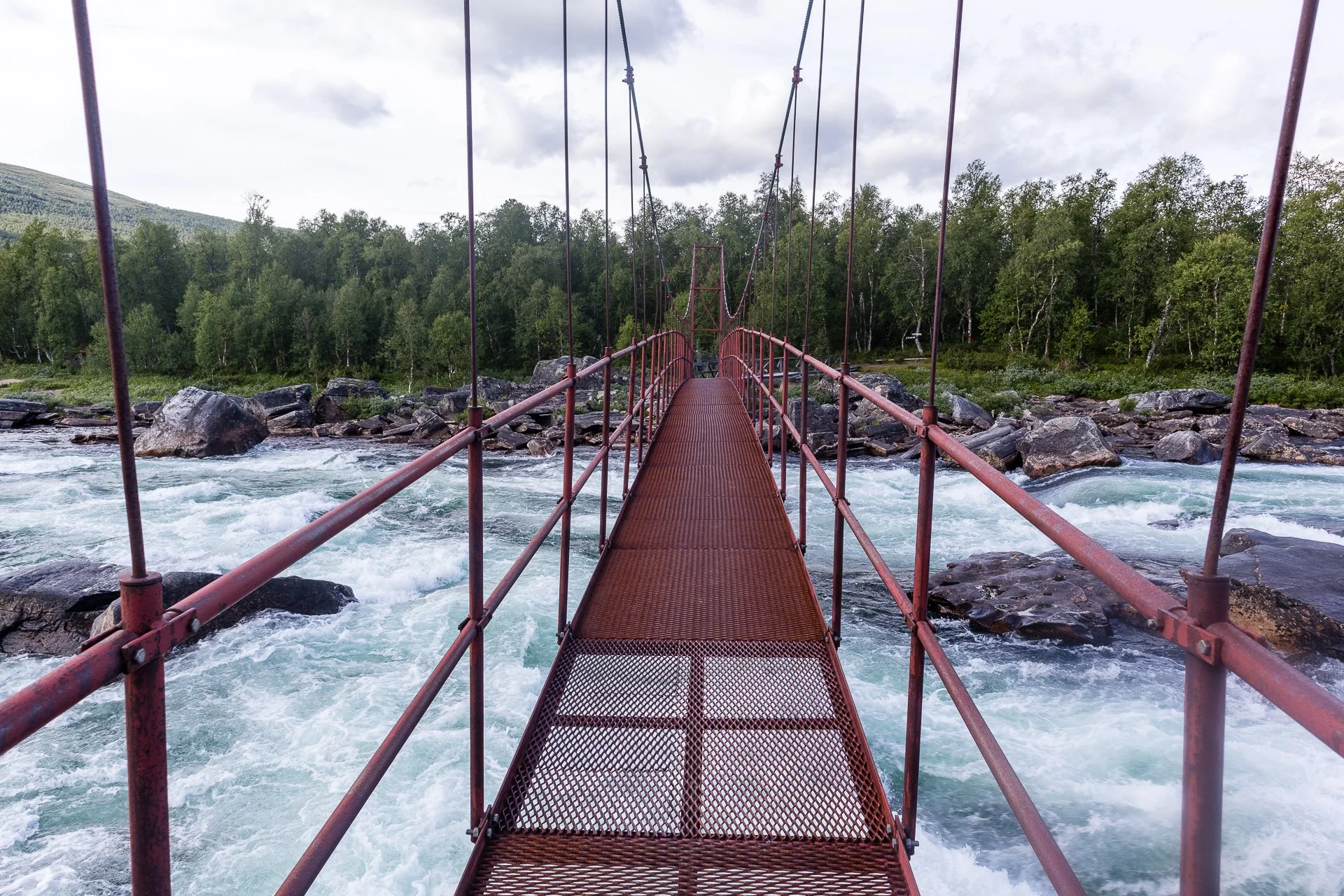
The initial trail is through beech forests, giving way to pine trees before you reach the wide river Laisälven (which leads into the lake you've just crossed by boat) and bridge over Laisälven a short distance from Bäverholmen. Just before the bridge is a fire pit with some crude benches and a beautiful view; its proximity to water and situation in the middle of the forest makes it a high mosquito area.
Rapids
The trail winds along the river, for some sections, right on the beach and others deeper in the forest, but you can always hear the roar of the water. It's a nice change of pace from some of the earlier sections, particularly walking along the river's edge.
Badasjåkkå Rastkkydd
After crossing a chain bridge, you come to Badasjåkkå Rastkkydd, a large, well-appointed cabin with a drop toilet and fire pit. I was there too early to stop for lunch, but otherwise, it would be a good option for a break. The sign here reads Ammarnäs 44km; I'd thought I'd only covered three kilometres, so I was beginning to expect to be very early to my room booking in Ammarnäs. (more time to see the Potato Hill!).
Lunch & Insects
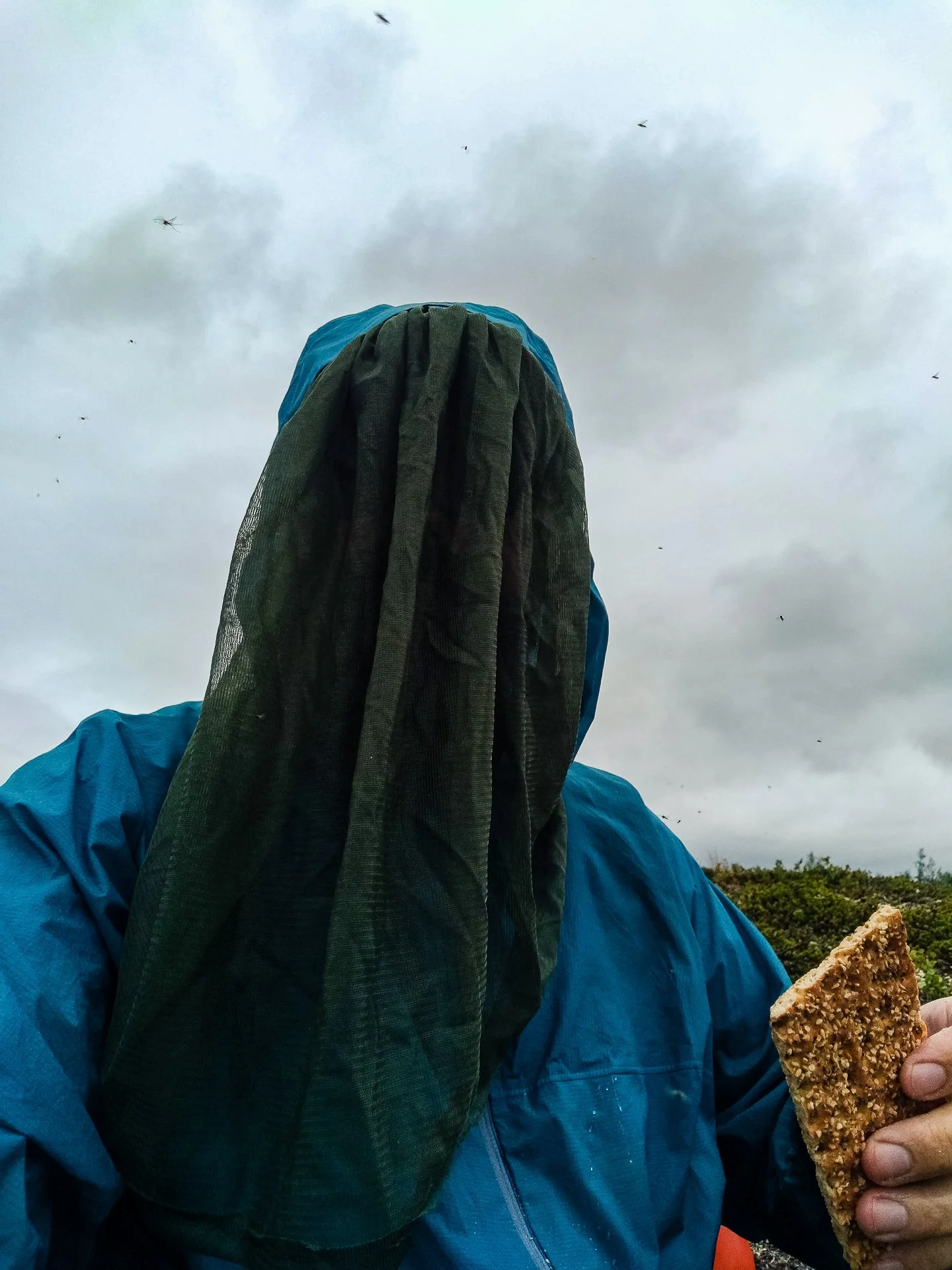
The trail from Badasjåkkå was less interesting; you clear the tree line and walk a lot in scrubland, mostly on a trail shared by ATVs (likely Reindeer herders). If the weather had been better, the views might have compensated, but it was quite cloudy. I came to a steep downhill to reach a bridge over some water, something I'd been holding out to stop for lunch and refill my canteen. I sat on a rock, covered as much as possible by my mosquito netting as the area was inundated with them. I also had my first encounter with some quite disgusting large-bodied flying insects. I never got a clear answer on what they were, but they seemed to almost float in the air with a long tail.
After leaving the bridge, the trail stopped being an ATV trail and returned to what I had come to think of as 'normal'. I met a couple on the trail heading north and asked them about the distance variations between the signs and the guidebooks. They told me there were two trails, leaving Ammarnäs, one going a longer route past Rävfallet and a second, more direct route that was quite a lot shorter and to keep an eye out for the T-Junction on the trail. I planned to stick to the original distances.
I reached Sjnultje Rastskydd at about 14:30. I'd intended to set up camp there but instead just made use of the drop toilet and had a chat with a guy I met in the cabin, which was heading north, and we swapped advice on our respective trail experiences. There was no running water nearby, which was my main reason to carry on hiking.
I left the cabin, looking for somewhere to stop in the next hour or so with water access. Still, the ground after Sjnultje was uneven and rocky for kilometre after kilometre, and I ended up walking partway through the Bird Sanctuary. Despite my concerns about the shorter distance to Ammarnäs, I ended up doing almost twenty kilometres (and an additional eight in the boat) before finding a spot to stop and camp.
My plan remains to follow my map and see. If I end up in the town a day early, I'll stay on an extra day and see the place and if not, great.
I managed to keep the door to the tent open for a while to enjoy the views, despite the mosquitos.
Approx: 19.4km
Total: 297.4 (+8km Boat) 71%
Day 20 - 7th:
Sunlight over the hill
I was on the trail at 8:50, and it wasn't long before I finished my trek through the bird sanctuary, with its low scrub bushes and rocks. The landscape quickly became grasslands with rolling hills and small sparking streams and rivers. Other than a single moderately steep climb, the walk is gentle, and the trail is excellent. I made excellent time, annoyingly, so give the shorter room to Ammarnäs. Lakes abound on both sides of the trail, and one of the largest lakes, a summer house sites in splendid isolation.
Lisvuojávrrie Bridge
A short climb gives you a view over the surrounding countryside along with a signpost. You can see the bridge over the small river stemming from Lisvuojávrrie lake. It can be assumed that in the winter, this whole area is much much higher due to snowfall, and the river runs higher too as the bridge is much taller and more impressive than the stream really warrants in summer, smaller than many you have to take your shoes off and ford.
Despite its claims being the least attended section of the trail, there are regular signposts all the way along, and the walkways were in generally good condition. Aside from a few broken bridges and a small number of overgrown trail sections, it has been good and not really any different than the 'curated' Kungsleden.
Wading time
From the hill just before the first big bridge, the Kungsleden signs' colour changes from Red to Orange. It is clear that this section has had some recent maintenance, but it is strange to be looking at a new colour after such a long hike.
It is still unclear if there is actually a longer route or not, and I made such a good time I was only three kilometres from where I intended to spend the night by midday, so I took a long break over lunch by the river in the shadow of the bridge.
It was not far to the two rivers I'd selected for my endpoint, and at first, there was a full-sized digger, begging the question of how it got there! For some reason, the perfectly good bridge was getting a new replacement. The following bridge was smaller and broken, and I wonder if a miscommunication had happened here.
I forded the river, filled my canteens and climbed the slope to find a lovely slop overlooking a large river in the distance.
These small birds make a single note 'cheep' sound and barely fly all through the trail. They hop around the trail. They're cute little things but odd.
Valley Views
It was an early stop for the day, but I'd covered my distance, and more and a more relaxed afternoon was not a bad thing. It also marked the point I'd covered 3/4 of Kungsleden. The end was in sight.
Approx 18km
Total 315km (75%)
Day 21 - 8th:
At 8:50 again, almost immediately heading downhill into beech forest slick with the previous nights light rain turning the trail to mud. The forest was incredibly humid, but the smell was fresh and verdant.
About forty-five minutes downhill (meeting a few people on the route, including one asking for directions), You come to the sign ← Ammarnäs | Rävfallet → Answering the question that had been bothering me the whole way since Adolfström. It is easy to imagine many people following the Ammarnäs trail, but that's not really the Kungsleden. You head via Rävfallet and a wider loop to reach Ammarnäs.
You'll pass several signs suggesting the short route back to Ammarnäs, including one at A??? Meadows, a small collection of huts on a gravel road.
One kilometre past the meadows, you reach Rävfallsstugan.

