Etapp 06 - Singistugorna - Kaitumjaurestugorna
This section runs alongside the sizable Tjäktjajäkka river and has several places where you likely need to remove your shoes to wade across the stone beds of smaller feeder streams. Deep enough that its unwise to cross just trusting to your boots waterproofing the water is bitingly cold on your feet and it is very much worth bringing some boat shoes with a grip, just for these crossings.

As you get closer to Kaitumajaure, the open grasslands and moors slowly turn to forests.
Trail Information
Distance: 13km
Difficulty: Easy
Transport: None
Resupply: None
Accommodation & Shopping
STF Singi
SIngi is a small collection of huts, accommodation, the hosts, wood store and drop toilets. It also offers plenty of free nearby camping in well-situated spots on route to the river. Many of the spots are in tony clearings of brush, giving some protection from the high winds that come down from the two valleys this cabin is situated between.


The location would be perfect in good weather, but the wind is incredible, and dark clouds followed. I weighed my tent ropes down with heavy rocks, the number and size of them already in my small site indicate I was not the first to think of this.
Whist the main facilities require you to pay for a camp spot, the hosts let you sit in the woodshed if you need to, and there are a few outside tables to use if the weather is good.
There was also the most adorable St. Bernard puppy, a playful 12 weeks old when I was there.

STF Singi doesn't have a shop, but like all others will sell you a patch.
Sights
Off to one side for the entire trail is Tjäktjajäkka, a beautiful river that eventually pours into Padje Kaitumajaure with some spectacular views.
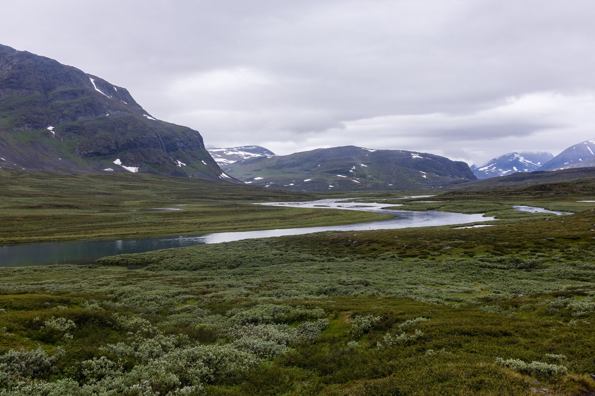
Tjäktjajäkka River
Pas the river, the mountains rise against the sky, with dark rock, white snow and green trees for a beautiful backdrop.
Side Trails
Kebnekaise
Not part of the King's Trail, but often considered it, the side trail to Kebnekaise is a very popular route, with many people starting in Abisko and ending their hike in Nikkaluokta, in the shadow of Kebnekaise mountain, making use of the Mountain Station to stash their gear and fuel up before tackling the climb.
The Experience
Day 4 - 22nd:
Having set up my tent, I spent some time in the woodshed to dry off a little and speak to some of the other campers and hikers who were passing through. It was my first meeting with Henrik, a German hiker carrying close to 30kgs on his back. He didn't stay on at Singi but was pushing on.
I also met quite a few others who were taking the route to Kebnekaise which branches off from Singi and takes you to Sweden's tallest mountain, including an Indian guy living in Malmo, doing the trail with his Sony and tripod (I was deeply jealous) and two Swedish guys who were fishing heading to Kvikkjokk.
I started thinking in detail about my connections as more information on the bus and boat timings were available from the STF hosts. The bus at Vakkotavare only comes at 9:50 and 14:35 getting there comfortably would require either getting to Vakkotavare early and camping overnight by the road or doing a long distance on the 23rd to ensure I make the connecting boat and doing a decent section of the trail the following day to make sure there is time to arrive at Vakkotavare by 14:35.
I spent a few hours outside in the light sun and breeze, I climbed into my tent at about 18:30, and it was then the rain started to come down heavily, and the wind picked up. But everything was locked down, and I was dry. Tomorrow was a different matter. Heavy rain expected all day and a 22km hike.
It was really at this point, laying in my tent with bad weather outside, four days in with twenty-three ahead of me, a miserable night the day before, that I really started to get a sense of the scale of the task ahead of me and how challenging it might become if the weather continued in this vein. I found myself already marking % done and distance and counting time to the first breakpoint as ways of making the distance seem more manageable.
The disconnection of the boats and bus timings is a little frustration and something that any hiker needs to consider. You may have your plans thrown aside and be waiting hours simply because that's the way the timetables are working.
One thing you come to realise is how much of what you eat is boredom and opportunity rather than hunger when home. My diet is limited, and there are few occasions to have anything extra, but I was not finding myself hungry much despite this. (600 calorie dinner, 500 for breakfast, 500 or so for lunch, 2-400 snack and a coffee and hot chocolate. Perhaps 2,200 total. )Given I was hiking tough trails with a heavy backpack, this was a surprise. When I passed SFT stations with shops, I'd buy a cola and a snack for variety, but that was working out to be every second day.
Day 5 - 23rd:
I was up and moving my 8:55, and quickly the rocks gave way to grass and moss with shrub bushes and sharp thorns. To the right, a wild and loud river ran past called the Tjäktjajäkka, until I climbed high enough to move away from it.

Tjäktjajäkka
From about 10:30, I was following Henrik, outlined against the sky in the distance as he walked the trail before me. I never quite caught up, but also never quite fell back out of sight. He was a faster walker, but I was a longer one.

The rain was never that heavy, but it was constant and wearing. I had my full waterproofs on and had got in the habit of storing them, when not in use, in the other pocket of my rucksack for easy access. The constant rain also meant I was depleting my solar battery every day, rather than filling on the hike.

Waterfall on rock
As you approach Kaitumjaurestugorna, you start to descend into the forest, which was damp and dripping when we arrived, I was slightly behind Henrik. A couple had arrived from the other direction just as we did.